
Cycling in Oberhofen im Inntal
Discover a map of 119 cycling routes and bike trails near Oberhofen im Inntal, created by our community.
Region portrait
Get to know Oberhofen im Inntal
Find the right bike route for you through Oberhofen im Inntal, where we've got 119 cycle routes to explore. Most people get on their bikes to ride here in the months of April and August.
4,236 km
Tracked distance
119
Cycle routes
Community
Most active users in Oberhofen im Inntal


From our community
The best bike routes in and around Oberhofen im Inntal

Pfaffenhofer Alm
Cycling route in Oberhofen im Inntal, Tyrol, Austria
- 7.9 km
- Distance
- 1,039 m
- Ascent
- 22 m
- Descent

Pfaffenhofener Alm (MTB)
Cycling route in Oberhofen im Inntal, Tyrol, Austria
- 9 km
- Distance
- 1,065 m
- Ascent
- 5 m
- Descent
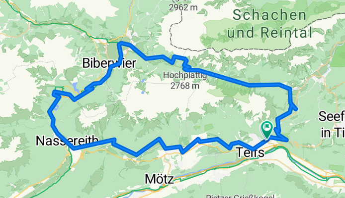
Telfs - Nassreith - Fernpass - Ehrwald - Gaistal
Cycling route in Oberhofen im Inntal, Tyrol, Austria
- 77.8 km
- Distance
- 1,928 m
- Ascent
- 1,924 m
- Descent

Telfs - Mötz - Badesee Mieming - Telfs
Cycling route in Oberhofen im Inntal, Tyrol, Austria
- 30.1 km
- Distance
- 413 m
- Ascent
- 414 m
- Descent
Discover more routes
 Telfs, Innsbruck Feber 2021
- Distance
- 57.7 km
- Ascent
- 14 m
- Descent
- 16 m
- Location
- Oberhofen im Inntal, Tyrol, Austria
![20231003-[H] Bike Point Innsbruck](https://media.bikemap.net/routes/13790858/staticmaps/in_e00ab36e-5509-4174-82b1-e2a1bb11658b_400x400_bikemap-2021-3D-static.png) 20231003-[H] Bike Point Innsbruck
20231003-[H] Bike Point Innsbruck- Distance
- 31.2 km
- Ascent
- 77 m
- Descent
- 132 m
- Location
- Oberhofen im Inntal, Tyrol, Austria
![20230426-[R] Landesstraße 12b Oberhofen im Inntal](https://media.bikemap.net/routes/12668861/staticmaps/in_f5578c65-20d6-42c0-a2f1-aec7720e01f9_400x400_bikemap-2021-3D-static.png) 20230426-[R] Landesstraße 12b Oberhofen im Inntal
20230426-[R] Landesstraße 12b Oberhofen im Inntal- Distance
- 29 km
- Ascent
- 87 m
- Descent
- 146 m
- Location
- Oberhofen im Inntal, Tyrol, Austria
![20230915-[H] Sportplatz Neu-Rum](https://media.bikemap.net/routes/13681180/staticmaps/in_bb7637a0-c00b-4319-bd45-6fb71b3e5a9f_400x400_bikemap-2021-3D-static.png) 20230915-[H] Sportplatz Neu-Rum
20230915-[H] Sportplatz Neu-Rum- Distance
- 34 km
- Ascent
- 122 m
- Descent
- 190 m
- Location
- Oberhofen im Inntal, Tyrol, Austria
 Telfsneu
- Distance
- 18 km
- Ascent
- 641 m
- Descent
- 150 m
- Location
- Oberhofen im Inntal, Tyrol, Austria
 Pfaffenhofener Alm
- Distance
- 8.5 km
- Ascent
- 1,224 m
- Descent
- 281 m
- Location
- Oberhofen im Inntal, Tyrol, Austria
![20231009-[H] Hängebrücke Haiming](https://media.bikemap.net/routes/13813506/staticmaps/in_b8941ba8-9c29-41ec-8611-517f5353dbba_400x400_bikemap-2021-3D-static.png) 20231009-[H] Hängebrücke Haiming
20231009-[H] Hängebrücke Haiming- Distance
- 29.6 km
- Ascent
- 207 m
- Descent
- 175 m
- Location
- Oberhofen im Inntal, Tyrol, Austria
![20230220-[R] Landesstraße 12b Oberhofen - Höttinger Au 52](https://media.bikemap.net/routes/12419571/staticmaps/in_97efcc9e-3101-4a3b-8e2c-8ede30c7767e_400x400_bikemap-2021-3D-static.png) 20230220-[R] Landesstraße 12b Oberhofen - Höttinger Au 52
20230220-[R] Landesstraße 12b Oberhofen - Höttinger Au 52- Distance
- 28.1 km
- Ascent
- 68 m
- Descent
- 124 m
- Location
- Oberhofen im Inntal, Tyrol, Austria