
Cycling in Kirchberg in Tirol
Discover a map of 430 cycling routes and bike trails near Kirchberg in Tirol, created by our community.
Region portrait
Get to know Kirchberg in Tirol
Find the right bike route for you through Kirchberg in Tirol, where we've got 430 cycle routes to explore. Most people get on their bikes to ride here in the months of July and August.
16,117 km
Tracked distance
430
Cycle routes
Community
Most active users in Kirchberg in Tirol


Handpicked routes
Discover Kirchberg in Tirol through these collections

Tour
From our community
The best bike routes in and around Kirchberg in Tirol
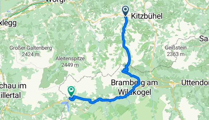
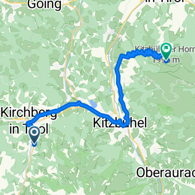
2 Kirchberg - Königsleiten
Cycling route in Kirchberg in Tirol, Tyrol, Austria
- 55.3 km
- Distance
- 2,332 m
- Ascent
- 1,577 m
- Descent
KB Gamskogelhütte 750Hm
Cycling route in Kirchberg in Tirol, Tyrol, Austria
- 25.8 km
- Distance
- 791 m
- Ascent
- 523 m
- Descent

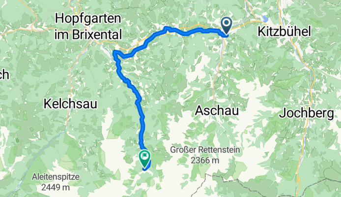
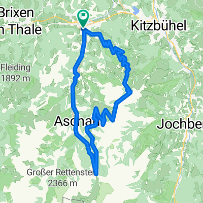
KB Hirtzegalm + Pengelstein
Cycling route in Kirchberg in Tirol, Tyrol, Austria
- 57.1 km
- Distance
- 2,441 m
- Ascent
- 2,441 m
- Descent
Discover more routes
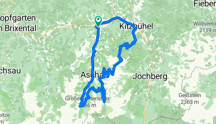
 KB Klooalm + Pengelstein
- Distance
- 39.3 km
- Ascent
- 2,022 m
- Descent
- 2,022 m
- Location
- Kirchberg in Tirol, Tyrol, Austria
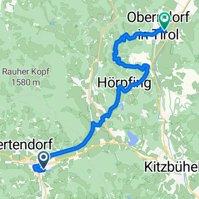 KB Oberndorf V2
- Distance
- 14.2 km
- Ascent
- 289 m
- Descent
- 438 m
- Location
- Kirchberg in Tirol, Tyrol, Austria
 Einfangweg, Kirchberg in Tirol nach Sankt Johann in Tirol
- Distance
- 21.7 km
- Ascent
- 1,078 m
- Descent
- 403 m
- Location
- Kirchberg in Tirol, Tyrol, Austria
 Kitzbüheler Runde
- Distance
- 33.2 km
- Ascent
- 227 m
- Descent
- 227 m
- Location
- Kirchberg in Tirol, Tyrol, Austria
 A Hohe Salve Rundfahrt
- Distance
- 57.7 km
- Ascent
- 560 m
- Descent
- 560 m
- Location
- Kirchberg in Tirol, Tyrol, Austria
 zweitausenter Aurach bei Kitzbühel
- Distance
- 42.1 km
- Ascent
- 1,402 m
- Descent
- 1,393 m
- Location
- Kirchberg in Tirol, Tyrol, Austria
 Kirchberg - Pengelstein - Kirchberg
- Distance
- 35.9 km
- Ascent
- 1,543 m
- Descent
- 1,598 m
- Location
- Kirchberg in Tirol, Tyrol, Austria
 AU Rettenbach - Runde in die Berge
- Distance
- 10.7 km
- Ascent
- 507 m
- Descent
- 508 m
- Location
- Kirchberg in Tirol, Tyrol, Austria