
Cycling in Hohenthurn
Discover a map of 240 cycling routes and bike trails near Hohenthurn, created by our community.
Region portrait
Get to know Hohenthurn
Find the right bike route for you through Hohenthurn, where we've got 240 cycle routes to explore. Most people get on their bikes to ride here in the months of July and August.
24,870 km
Tracked distance
240
Cycle routes
Community
Most active users in Hohenthurn


From our community
The best bike routes in and around Hohenthurn


🚴♀️E*Bike🇦🇹 17.05.20. 4. Tag Kanatalradweg
Cycling route in Hohenthurn, Carinthia, Austria
- 53.1 km
- Distance
- 304 m
- Ascent
- 636 m
- Descent
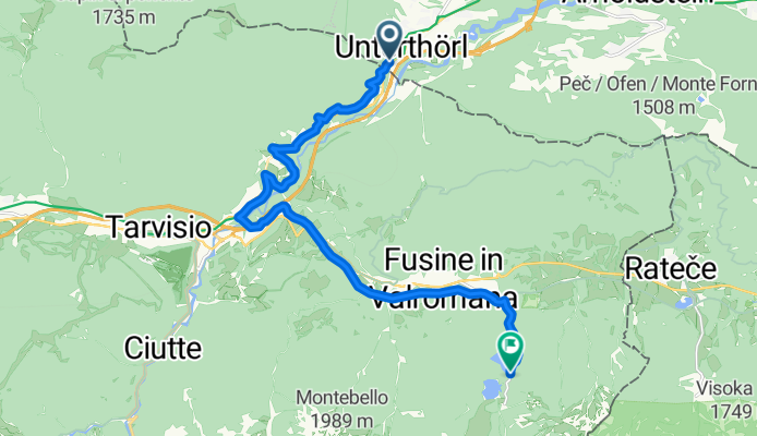
Von Arnoldstein bis lago di fusine
Cycling route in Hohenthurn, Carinthia, Austria
- 15.5 km
- Distance
- 691 m
- Ascent
- 413 m
- Descent


Discover more routes
 Bad Bleiberg - Villacher Alpenstraße
- Distance
- 34.3 km
- Ascent
- 1,568 m
- Descent
- 468 m
- Location
- Hohenthurn, Carinthia, Austria
 MTB-Berg: Draschitz - Feistritz/Gail - Feistritzbach - Bartolosattel - Tarvisio - Unterthörl - Draschitz
- Distance
- 30.3 km
- Ascent
- 900 m
- Descent
- 901 m
- Location
- Hohenthurn, Carinthia, Austria
 soca
soca- Distance
- 99.4 km
- Ascent
- 2,367 m
- Descent
- 2,353 m
- Location
- Hohenthurn, Carinthia, Austria
 Göriacheralm
- Distance
- 38.6 km
- Ascent
- 1,140 m
- Descent
- 1,139 m
- Location
- Hohenthurn, Carinthia, Austria
 Von Arnoldstein bis Tarvis
- Distance
- 9.9 km
- Ascent
- 390 m
- Descent
- 300 m
- Location
- Hohenthurn, Carinthia, Austria
 MTB-Trail: ThörlMaglernZoll-Pressendellach-Draschitz-Göriach-Achomitz-AchomitzerAlm-TRAIL-WW508-ArlecchinoTRAIL-Camporosso-Tarvisio-Coccau-ThörlMaglernZoll
- Distance
- 37.4 km
- Ascent
- 1,474 m
- Descent
- 1,470 m
- Location
- Hohenthurn, Carinthia, Austria
 Hohenthurn Radfahren
- Distance
- 97.3 km
- Ascent
- 1,262 m
- Descent
- 1,245 m
- Location
- Hohenthurn, Carinthia, Austria
 Bartolosattel
- Distance
- 32.1 km
- Ascent
- 660 m
- Descent
- 657 m
- Location
- Hohenthurn, Carinthia, Austria
Routes from Hohenthurn
Quick ride by bicycle from
Hohenthurn to Tarvisio
Routes to Hohenthurn
Cycling day trip from
Villach to Hohenthurn