
Cycling in Anras
Discover a map of 39 cycling routes and bike trails near Anras, created by our community.
Region portrait
Get to know Anras
Find the right bike route for you through Anras, where we've got 39 cycle routes to explore. Most people get on their bikes to ride here in the month of July.
2,721 km
Tracked distance
39
Cycle routes
Community
Most active users in Anras


From our community
The best bike routes in and around Anras


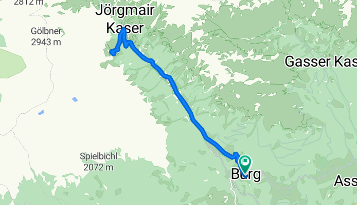
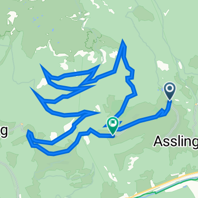
Burg - Gölbnerblickhütte
Cycling route in Anras, Tyrol, Austria
- 17.1 km
- Distance
- 556 m
- Ascent
- 541 m
- Descent
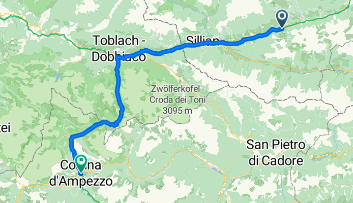
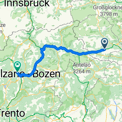
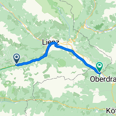
7. Etappe_Mittenwald an der Drau-Cortina d'Ampezzo
Cycling route in Anras, Tyrol, Austria
- 62.8 km
- Distance
- 671 m
- Ascent
- 326 m
- Descent
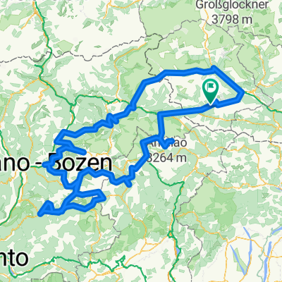
Mittewald 156, Mittewald an der Drau nach Mittewald 154, Mittewald an der Drau
Cycling route in Anras, Tyrol, Austria
- 37.5 km
- Distance
- 2,346 m
- Ascent
- 2,340 m
- Descent
Discover more routes
 RBRrower-dzien 6-03.08.16
- Distance
- 161.8 km
- Ascent
- 451 m
- Descent
- 1,057 m
- Location
- Anras, Tyrol, Austria
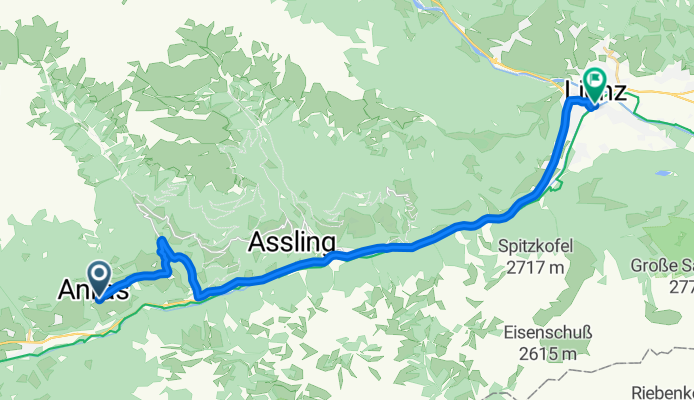
 Oberassling 70/1 nach Pustertaler Höhenstraße
- Distance
- 14 km
- Ascent
- 843 m
- Descent
- 727 m
- Location
- Anras, Tyrol, Austria
 Assling - Monte Crostis 155km
- Distance
- 155.3 km
- Ascent
- 3,795 m
- Descent
- 2,939 m
- Location
- Anras, Tyrol, Austria
 7 Alpentour gesamt
- Distance
- 545.8 km
- Ascent
- 7,924 m
- Descent
- 7,988 m
- Location
- Anras, Tyrol, Austria
 1. Etappe - 7. Alpentour
- Distance
- 101.3 km
- Ascent
- 1,469 m
- Descent
- 1,633 m
- Location
- Anras, Tyrol, Austria
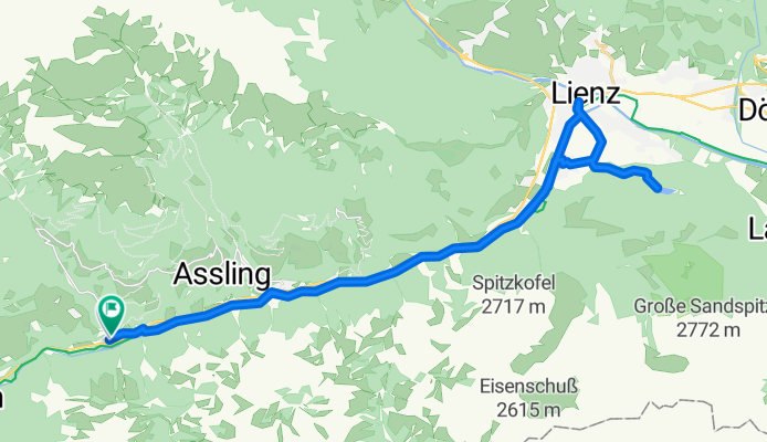
 Anras - Mühldorf
- Distance
- 91 km
- Ascent
- 1,099 m
- Descent
- 1,422 m
- Location
- Anras, Tyrol, Austria
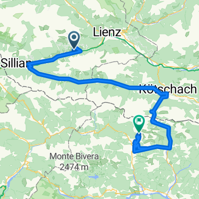
 Anras - Nikolsdorf
- Distance
- 26.9 km
- Ascent
- 277 m
- Descent
- 459 m
- Location
- Anras, Tyrol, Austria
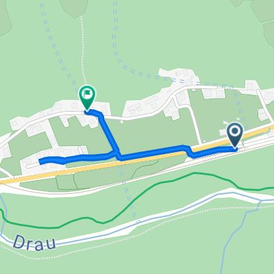 100, Anras to Mittewald 60, Anras
- Distance
- 0.9 km
- Ascent
- 10 m
- Descent
- 3 m
- Location
- Anras, Tyrol, Austria