
Cycling in Weidenthal
Discover a map of 20 cycling routes and bike trails near Weidenthal, created by our community.
Region portrait
Get to know Weidenthal
Find the right bike route for you through Weidenthal, where we've got 20 cycle routes to explore.
2,707 km
Tracked distance
20
Cycle routes
2,018
Population
From our community
The best bike routes in and around Weidenthal

2012 Saupferch-Drachenfels
Cycling route in Weidenthal, Rhineland-Palatinate, Germany
- 5.8 km
- Distance
- 363 m
- Ascent
- 82 m
- Descent

Track 001
Cycling route in Weidenthal, Rhineland-Palatinate, Germany
- 10.6 km
- Distance
- 401 m
- Ascent
- 401 m
- Descent

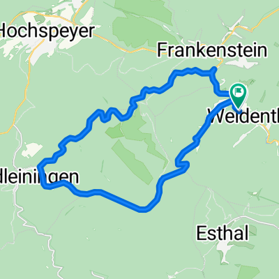
weidenthal - esthal - weidenthal
Cycling route in Weidenthal, Rhineland-Palatinate, Germany
- 13.5 km
- Distance
- 402 m
- Ascent
- 401 m
- Descent

NW - Eiswoog - NW
Cycling route in Weidenthal, Rhineland-Palatinate, Germany
- 65.5 km
- Distance
- 722 m
- Ascent
- 735 m
- Descent
Discover more routes
 Weidenthal 1
- Distance
- 7.2 km
- Ascent
- 256 m
- Descent
- 253 m
- Location
- Weidenthal, Rhineland-Palatinate, Germany
 B39 Morschbacherhof Esthal Breitenstein
- Distance
- 11.8 km
- Ascent
- 305 m
- Descent
- 336 m
- Location
- Weidenthal, Rhineland-Palatinate, Germany
 Runde um den Erlenkopf
- Distance
- 103.1 km
- Ascent
- 2,346 m
- Descent
- 2,383 m
- Location
- Weidenthal, Rhineland-Palatinate, Germany
 Saupferch - Drachenfels
- Distance
- 15.9 km
- Ascent
- 570 m
- Descent
- 576 m
- Location
- Weidenthal, Rhineland-Palatinate, Germany
 Drachenfels - Neustadt
- Distance
- 17.6 km
- Ascent
- 208 m
- Descent
- 626 m
- Location
- Weidenthal, Rhineland-Palatinate, Germany
 Tageswanderung Drachenfels
- Distance
- 14.9 km
- Ascent
- 476 m
- Descent
- 517 m
- Location
- Weidenthal, Rhineland-Palatinate, Germany
 Weidenthal Radfahren
- Distance
- 14.1 km
- Ascent
- 409 m
- Descent
- 430 m
- Location
- Weidenthal, Rhineland-Palatinate, Germany
 Gemütliche Fahrt
- Distance
- 23.1 km
- Ascent
- 523 m
- Descent
- 530 m
- Location
- Weidenthal, Rhineland-Palatinate, Germany