
Cycling in Türkenfeld
Discover a map of 63 cycling routes and bike trails near Türkenfeld, created by our community.
Region portrait
Get to know Türkenfeld
Find the right bike route for you through Türkenfeld, where we've got 63 cycle routes to explore. Most people get on their bikes to ride here in the month of June.
1,818 km
Tracked distance
63
Cycle routes
3,397
Population
Community
Most active users in Türkenfeld

From our community
The best bike routes in and around Türkenfeld

Türkenfeld-Mering
Cycling route in Türkenfeld, Bavaria, Germany
Bahnhofstraße 30, 82299 Türkenfeld
Andechser in Mering
Mittwoch - Montag: 10:00 bis 23:00
- 63.1 km
- Distance
- 386 m
- Ascent
- 387 m
- Descent

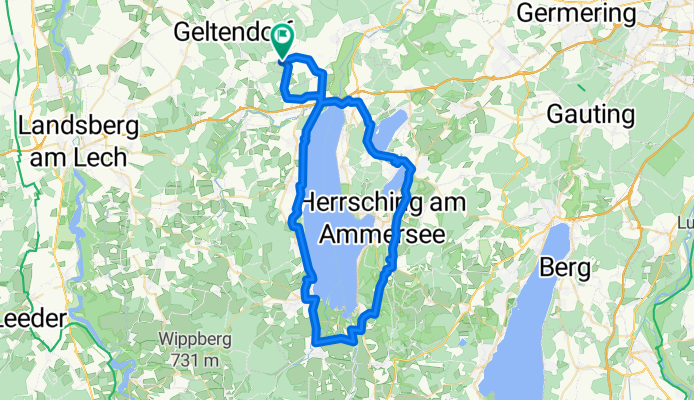
Lechtour von Türkenfeld nach Diedorf
Cycling route in Türkenfeld, Bavaria, Germany
Tour den Lech entlang. Startpunkt ist die S-Bahnstation Türkenfeld. Von Dort nach St. Ottilien und weiter nach Eresing. Ab dort dem Ammerseeradweg bis Landsberg folgen. Von dort aus nordwärts immer am Lech entlang. Bis zu ersten Staustufe kann man linkslechlich(?) dem R1 folgen, bevor man in Kaufering die Seite wechselt und sich auf der rechten Seite weiterbewegt. Der Wanderweg Romantische Straße führt direkt am Ufer entlang ist aber kein Radweg. Robuste Fahrweise und Rücksicht auf die Wanderer sind hier angemessen, da der Weg oft nur gut Schulterbreit ist. An der Staustufe 22 wieder die Seite wechseln und nun dem kleinen Bach folgen, der bis Haunstetten immer schöner wird. Dort links in den Ort und weiter ins Tal über Inningen an den Wertach-Radweg. Diesem nordwärts folgen bis zur nächsten Straße. Dort links nach Wellenburg. Jetzt folgt der letzte Anstieg über einen Höhenzug hinweg nach Anhausen und Diedorf. Dort gibt es einen Bahnhof, von wo man stündlich nach Augsburg/München weiterkommt.
- 69.3 km
- Distance
- 203 m
- Ascent
- 333 m
- Descent

Türkenfeld-Funkturm-Ampertal-300HM
Cycling route in Türkenfeld, Bavaria, Germany
24.05.15 19:10
(cloned from route 3047000)
- 32.8 km
- Distance
- 208 m
- Ascent
- 208 m
- Descent
St-Ottilien-Straße, Türkenfeld nach St-Ottilien-Straße, Türkenfeld
Cycling route in Türkenfeld, Bavaria, Germany
- 64.4 km
- Distance
- 588 m
- Ascent
- 588 m
- Descent
Discover more routes
 Jexhof - Türkenfeld
- Distance
- 12 km
- Ascent
- 53 m
- Descent
- 76 m
- Location
- Türkenfeld, Bavaria, Germany
 2007_Türkenfeld_Tutzing
- Distance
- 60.5 km
- Ascent
- 320 m
- Descent
- 305 m
- Location
- Türkenfeld, Bavaria, Germany
 50 - 00 - TF - Ottilien
- Distance
- 4.8 km
- Ascent
- 5 m
- Descent
- 12 m
- Location
- Türkenfeld, Bavaria, Germany
 Graf-Schenk-Straße 2, Türkenfeld nach Hauptstraße 11, Seefeld
- Distance
- 19.8 km
- Ascent
- 212 m
- Descent
- 241 m
- Location
- Türkenfeld, Bavaria, Germany
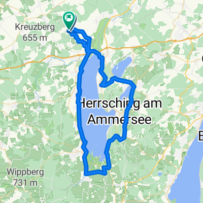 Türkenfeld-Ammersee-Andechs-509Hm
- Distance
- 64.9 km
- Ascent
- 326 m
- Descent
- 326 m
- Location
- Türkenfeld, Bavaria, Germany
 Moorenweiser Straße nach Hubert-von-Herkomer-Straße
- Distance
- 20.5 km
- Ascent
- 111 m
- Descent
- 160 m
- Location
- Türkenfeld, Bavaria, Germany
 Recorded via Apple Watch - 30.05.21, 17:41
- Distance
- 15.6 km
- Ascent
- 78 m
- Descent
- 81 m
- Location
- Türkenfeld, Bavaria, Germany
 Geltendorfer Straße 9, Türkenfeld nach Seefeld
- Distance
- 22.2 km
- Ascent
- 284 m
- Descent
- 323 m
- Location
- Türkenfeld, Bavaria, Germany