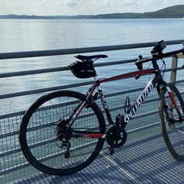
Cycling in Treuchtlingen
Discover a map of 486 cycling routes and bike trails near Treuchtlingen, created by our community.
Region portrait
Get to know Treuchtlingen
Find the right bike route for you through Treuchtlingen, where we've got 486 cycle routes to explore. Most people get on their bikes to ride here in the months of June and August.
34,860 km
Tracked distance
486
Cycle routes
13,141
Population
From our community
The best bike routes in and around Treuchtlingen
Von Treuchtlingen bis Kinding
Cycling route in Treuchtlingen, Bavaria, Germany
- 74.7 km
- Distance
- 792 m
- Ascent
- 839 m
- Descent
36_Treuchtlingen – Walting
Cycling route in Treuchtlingen, Bavaria, Germany
Eichstätt – das Zentrum des Naturparks Altmühltal Charakter: Landschaftlich besonders schöner Streckenabschnitt. Der Weg führt ohne Steigungen entlang der Altmühl, ist sehr gut ausgebaut und beschildert. Verkehr: Überwiegend Radwege. Passender Reiseführer: KOMPASS 6404 Altmühlradweg, Karin Hornberg,
- 56 km
- Distance
- 222 m
- Ascent
- 253 m
- Descent
Treuchtlingen - Nürnberg
Cycling route in Treuchtlingen, Bavaria, Germany
Von Treuchtlingen-Schambach nach Nürnberg, Donaustraße
- 158.7 km
- Distance
- 1,445 m
- Ascent
- 1,425 m
- Descent
Discover more routes
 Altmühltal Wettelsheim-Wenzenbach
- Distance
- 191.6 km
- Ascent
- 246 m
- Descent
- 288 m
- Location
- Treuchtlingen, Bavaria, Germany
 Panoramarunde - Altmühltal
- Distance
- 46.8 km
- Ascent
- 858 m
- Descent
- 859 m
- Location
- Treuchtlingen, Bavaria, Germany
 wettelsheim - Pappenheim - Solnhofen
- Distance
- 57.8 km
- Ascent
- 3,508 m
- Descent
- 3,512 m
- Location
- Treuchtlingen, Bavaria, Germany
 Wettelsheimer Wald
- Distance
- 35.3 km
- Ascent
- 432 m
- Descent
- 432 m
- Location
- Treuchtlingen, Bavaria, Germany
 Panoramatour 5 - Treuchtlingen
- Distance
- 46.8 km
- Ascent
- 819 m
- Descent
- 819 m
- Location
- Treuchtlingen, Bavaria, Germany
 Treuchtlingen - Nürnberg
- Distance
- 71.3 km
- Ascent
- 275 m
- Descent
- 395 m
- Location
- Treuchtlingen, Bavaria, Germany
 Panorama Tour Treuchtlingen
- Distance
- 45.8 km
- Ascent
- 853 m
- Descent
- 854 m
- Location
- Treuchtlingen, Bavaria, Germany
 Wettelsheimer Keller-Runde
- Distance
- 7.2 km
- Ascent
- 115 m
- Descent
- 115 m
- Location
- Treuchtlingen, Bavaria, Germany
Routes from Treuchtlingen
Cycling day trip from
Treuchtlingen to Eichstätt
Routes to Treuchtlingen
Cycling day trip from
Gunzenhausen to Treuchtlingen


