Cycling in Steingaden
Discover a map of 166 cycling routes and bike trails near Steingaden, created by our community.
Region portrait
Get to know Steingaden
Find the right bike route for you through Steingaden, where we've got 166 cycle routes to explore. Most people get on their bikes to ride here in the months of July and August.
8,736 km
Tracked distance
166
Cycle routes
2,828
Population
From our community
The best bike routes in and around Steingaden
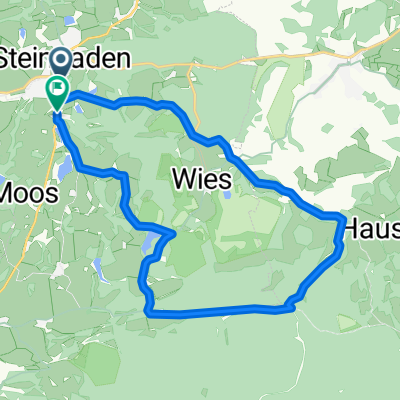
Steingaden Saulgrub
Cycling route in Steingaden, Bavaria, Germany
- 41.5 km
- Distance
- 409 m
- Ascent
- 409 m
- Descent
Wieskirche-Wildsteig-Rottenbuch, Rundtour. für Helmut
Cycling route in Steingaden, Bavaria, Germany
- 65.3 km
- Distance
- 1,338 m
- Ascent
- 1,448 m
- Descent
Steingaden,Forgensee, Weißensee, Schloss 70km 450hm
Cycling route in Steingaden, Bavaria, Germany
- 71.2 km
- Distance
- 405 m
- Ascent
- 367 m
- Descent
Discover more routes
 Steingaden - Tutzing
- Distance
- 67.8 km
- Ascent
- 619 m
- Descent
- 781 m
- Location
- Steingaden, Bavaria, Germany
 Tour 2020 Etappe 3
- Distance
- 120 km
- Ascent
- 261 m
- Descent
- 558 m
- Location
- Steingaden, Bavaria, Germany
 Tour 3 Königsstraße
- Distance
- 69.6 km
- Ascent
- 1,060 m
- Descent
- 1,061 m
- Location
- Steingaden, Bavaria, Germany
 Utg - OStB Tag 2
- Distance
- 36.7 km
- Ascent
- 318 m
- Descent
- 489 m
- Location
- Steingaden, Bavaria, Germany
 Wies 1, Steingaden nach Weidachstraße 74, Füssen
- Distance
- 30.6 km
- Ascent
- 1,119 m
- Descent
- 1,195 m
- Location
- Steingaden, Bavaria, Germany
 Urspring-Roßhaupten-Seeg-Hopfen-Roßhaupten-Urspring
- Distance
- 69 km
- Ascent
- 438 m
- Descent
- 437 m
- Location
- Steingaden, Bavaria, Germany
 Graf-Dürckheim-Straße 8, Steingaden nach Schloßbergstraße 1, Murnau am Staffelsee
- Distance
- 36.6 km
- Ascent
- 527 m
- Descent
- 616 m
- Location
- Steingaden, Bavaria, Germany
 Wieskirchenregion kurz
- Distance
- 17.7 km
- Ascent
- 209 m
- Descent
- 191 m
- Location
- Steingaden, Bavaria, Germany


