
Cycling in Stadtlengsfeld
Discover a map of 37 cycling routes and bike trails near Stadtlengsfeld, created by our community.
Region portrait
Get to know Stadtlengsfeld
Find the right bike route for you through Stadtlengsfeld, where we've got 37 cycle routes to explore.
1,205 km
Tracked distance
37
Cycle routes
2,698
Population
Community
Most active users in Stadtlengsfeld


From our community
The best bike routes in and around Stadtlengsfeld

Alleeweg 5G, Dermbach nach Alleeweg 5G, Dermbach
Cycling route in Stadtlengsfeld, Free State of Thuringia, Germany
- 20.5 km
- Distance
- 512 m
- Ascent
- 508 m
- Descent

Erfurt Stadtlengsfeld 94km
Cycling route in Stadtlengsfeld, Free State of Thuringia, Germany
- 95.3 km
- Distance
- 738 m
- Ascent
- 821 m
- Descent

Alleeweg 7B, Dermbach nach Alleeweg 5H, Dermbach
Cycling route in Stadtlengsfeld, Free State of Thuringia, Germany
- 14 km
- Distance
- 323 m
- Ascent
- 325 m
- Descent

Alleeweg 5G, Dermbach nach Alleeweg 13, Dermbach
Cycling route in Stadtlengsfeld, Free State of Thuringia, Germany
- 26.7 km
- Distance
- 399 m
- Ascent
- 398 m
- Descent
Discover more routes
 Borntalstraße 5, Merkers-Kieselbach nach Ernst-Thälmann-Straße 42, Merkers-Kieselbach
- Distance
- 91.5 km
- Ascent
- 799 m
- Descent
- 843 m
- Location
- Stadtlengsfeld, Free State of Thuringia, Germany
 Am Burgplatz 19, Stadtlengsfeld nach Am Burgplatz 19, Stadtlengsfeld
- Distance
- 26.4 km
- Ascent
- 431 m
- Descent
- 436 m
- Location
- Stadtlengsfeld, Free State of Thuringia, Germany
 Feldatalradweg
- Distance
- 59.9 km
- Ascent
- 552 m
- Descent
- 552 m
- Location
- Stadtlengsfeld, Free State of Thuringia, Germany
 Feldaradweg
- Distance
- 36.7 km
- Ascent
- 425 m
- Descent
- 283 m
- Location
- Stadtlengsfeld, Free State of Thuringia, Germany
 13km-Rundwanderg. um StadtLF
- Distance
- 12.4 km
- Ascent
- 1,639 m
- Descent
- 2,097 m
- Location
- Stadtlengsfeld, Free State of Thuringia, Germany
 Alleeweg 7B, Dermbach nach Alleeweg 5G, Dermbach
- Distance
- 24.2 km
- Ascent
- 363 m
- Descent
- 363 m
- Location
- Stadtlengsfeld, Free State of Thuringia, Germany
 Alleeweg 5G, Dermbach nach Karl-Liebknecht-Straße 21, Dermbach
- Distance
- 25.3 km
- Ascent
- 503 m
- Descent
- 512 m
- Location
- Stadtlengsfeld, Free State of Thuringia, Germany
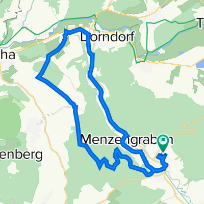
 Menzengraben-Kaltenborn
- Distance
- 26.3 km
- Ascent
- 266 m
- Descent
- 217 m
- Location
- Stadtlengsfeld, Free State of Thuringia, Germany