
Cycling in Pfaffen-Schwabenheim
Discover a map of 37 cycling routes and bike trails near Pfaffen-Schwabenheim, created by our community.
Region portrait
Get to know Pfaffen-Schwabenheim
Find the right bike route for you through Pfaffen-Schwabenheim, where we've got 37 cycle routes to explore. Most people get on their bikes to ride here in the month of June.
1,404 km
Tracked distance
37
Cycle routes
1,310
Population
Community
Most active users in Pfaffen-Schwabenheim


From our community
The best bike routes in and around Pfaffen-Schwabenheim

2014_06_08
Cycling route in Pfaffen-Schwabenheim, Rhineland-Palatinate, Germany
leichte Runde, heute aber bei großer Hitze, schwitz...
- 43.9 km
- Distance
- 345 m
- Ascent
- 346 m
- Descent
2015_06_14_Vorbereitung
Cycling route in Pfaffen-Schwabenheim, Rhineland-Palatinate, Germany
Sontagsdtour
(cloned from route 3089670)
- 65.5 km
- Distance
- 706 m
- Ascent
- 706 m
- Descent

2012_05_27
Cycling route in Pfaffen-Schwabenheim, Rhineland-Palatinate, Germany
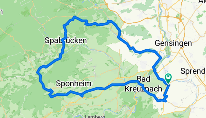
Bosenheim, Bad KH. Rüdesheim, Spohnheim, Bockenau, Winterberg, Allenfeld, Argenschwang, Spabrücken, Dalberg, Wallhausen, Gutenberg, Hargesheim, Roxheim, Bad KH, Bosenheim
- 55.2 km
- Distance
- 514 m
- Ascent
- 514 m
- Descent

2013_01_06
Cycling route in Pfaffen-Schwabenheim, Rhineland-Palatinate, Germany
- 33.8 km
- Distance
- 288 m
- Ascent
- 288 m
- Descent
Discover more routes
 2012_05_28
- Distance
- 40.2 km
- Ascent
- 273 m
- Descent
- 273 m
- Location
- Pfaffen-Schwabenheim, Rhineland-Palatinate, Germany
 2012_05_26
- Distance
- 63.2 km
- Ascent
- 482 m
- Descent
- 482 m
- Location
- Pfaffen-Schwabenheim, Rhineland-Palatinate, Germany
 Rheinradeln Bacharach
- Distance
- 64.8 km
- Ascent
- 198 m
- Descent
- 198 m
- Location
- Pfaffen-Schwabenheim, Rhineland-Palatinate, Germany
 L 413, Pfaffen-Schwabenheim nach Mannheimer Straße 28, Bad Kreuznach
- Distance
- 16.1 km
- Ascent
- 181 m
- Descent
- 198 m
- Location
- Pfaffen-Schwabenheim, Rhineland-Palatinate, Germany
 L 413 74, Bad Kreuznach nach Hugo-Salzmann-Straße 18A, Bad Kreuznach
- Distance
- 2.5 km
- Ascent
- 49 m
- Descent
- 52 m
- Location
- Pfaffen-Schwabenheim, Rhineland-Palatinate, Germany
 Kreuznacher Straße 72, Pfaffen-Schwabenheim nach Am Plan 1, Oberwesel
- Distance
- 45.8 km
- Ascent
- 262 m
- Descent
- 292 m
- Location
- Pfaffen-Schwabenheim, Rhineland-Palatinate, Germany
 SeRi_1
- Distance
- 170.9 km
- Ascent
- 184 m
- Descent
- 200 m
- Location
- Pfaffen-Schwabenheim, Rhineland-Palatinate, Germany
 PfaffenSchw.1
- Distance
- 10.2 km
- Ascent
- 167 m
- Descent
- 161 m
- Location
- Pfaffen-Schwabenheim, Rhineland-Palatinate, Germany