
Cycling in Oberstdorf
Discover a map of 1,430 cycling routes and bike trails near Oberstdorf, created by our community.
Region portrait
Get to know Oberstdorf
Find the right bike route for you through Oberstdorf, where we've got 1,430 cycle routes to explore. Most people get on their bikes to ride here in the months of June and July.
145,924 km
Tracked distance
1,430
Cycle routes
9,788
Population
Community
Most active users in Oberstdorf


Handpicked routes
Discover Oberstdorf through these collections
Tour
Tour
From our community
The best bike routes in and around Oberstdorf

Transalp Oberstdorf - Stilfserjoch - Laas
Cycling route in Oberstdorf, Bavaria, Germany
Möglich wäre auch am letzten Tag die Fahrt zum Comersee. Wir haben uns dagegen entschieden, da die Zuganbindung nach München noch schlechter ist als von Südtirol über den Brenner.
- 289.9 km
- Distance
- 7,211 m
- Ascent
- 7,110 m
- Descent

Oberstdorf - Rohrmoostal - Lecknertal
Cycling route in Oberstdorf, Bavaria, Germany
Jahresabschlußfahrt des TVA 2009.
Laut Tacho: 76km, 1440Hm
- 74.8 km
- Distance
- 1,190 m
- Ascent
- 1,190 m
- Descent

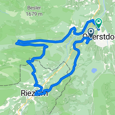
Oberstdorf - Königsträßchen
Cycling route in Oberstdorf, Bavaria, Germany
Oberstdorf - Tiefenbach - Obermaiselstein - Bolsterlang - Ofterschwang - Westerhofen - Oberzollbrücke - Blaichach - Burgberg - Rettenberg - Kranzegg - Königsträßchen - Burgberg - Sonthofen - Altstädten - Reichenbach - Rubi - Oberstdorf
Laut Tacho: 65km, 900Hm
- 64.7 km
- Distance
- 785 m
- Ascent
- 785 m
- Descent

1) Stillacherstr. - Trettachtal + zurück
Cycling route in Oberstdorf, Bavaria, Germany
- 19.9 km
- Distance
- 241 m
- Ascent
- 268 m
- Descent
Discover more routes
 Transalp Etappe 1: Oberstdorf - Dalaas
- Distance
- 55.4 km
- Ascent
- 1,503 m
- Descent
- 1,458 m
- Location
- Oberstdorf, Bavaria, Germany
 Oberstdorf - Käseralpe
- Distance
- 22.8 km
- Ascent
- 631 m
- Descent
- 630 m
- Location
- Oberstdorf, Bavaria, Germany
 Illerradweg
- Distance
- 145.8 km
- Ascent
- 342 m
- Descent
- 676 m
- Location
- Oberstdorf, Bavaria, Germany
 Oberstdorf Marathon 2015 Mittelstrecke
- Distance
- 32.2 km
- Ascent
- 733 m
- Descent
- 735 m
- Location
- Oberstdorf, Bavaria, Germany
 Breitach Kleinwalsertal
- Distance
- 33.9 km
- Ascent
- 715 m
- Descent
- 709 m
- Location
- Oberstdorf, Bavaria, Germany
 7) Radtour Kleinwalsertal
- Distance
- 34.1 km
- Ascent
- 899 m
- Descent
- 902 m
- Location
- Oberstdorf, Bavaria, Germany
 Balderschwang Riedbergpass
- Distance
- 50.1 km
- Ascent
- 1,065 m
- Descent
- 1,065 m
- Location
- Oberstdorf, Bavaria, Germany
 MTB Oberstdorf - DAY_5 (6_2009) - Kanzelwand
- Distance
- 43.4 km
- Ascent
- 1,377 m
- Descent
- 1,377 m
- Location
- Oberstdorf, Bavaria, Germany
Routes from Oberstdorf
Cycling day trip from
Oberstdorf to Kempten (Allgäu)
Cycling day trip from
Oberstdorf to Immenstadt im Allgäu
Routes to Oberstdorf
Cycling day trip from
Immenstadt im Allgäu to Oberstdorf
Quick ride by bicycle from
Bolsterlang to Oberstdorf
Quick ride by bicycle from
Sonthofen to Oberstdorf