
Cycling in Oberstaufenbach
Discover a map of 8 cycling routes and bike trails near Oberstaufenbach, created by our community.
Region portrait
Get to know Oberstaufenbach
Find the right bike route for you through Oberstaufenbach, where we've got 8 cycle routes to explore.
168 km
Tracked distance
8
Cycle routes
272
Population
Community
Most active users in Oberstaufenbach
From our community
The best bike routes in and around Oberstaufenbach
Ride to work
Cycling route in Oberstaufenbach, Rhineland-Palatinate, Germany
- 11.6 km
- Distance
- 190 m
- Ascent
- 211 m
- Descent
40K-Loop
Cycling route in Oberstaufenbach, Rhineland-Palatinate, Germany
- 40.5 km
- Distance
- 293 m
- Ascent
- 293 m
- Descent
30K-Loop
Cycling route in Oberstaufenbach, Rhineland-Palatinate, Germany
- 31.2 km
- Distance
- 328 m
- Ascent
- 328 m
- Descent
Potzberg-Ostanfahrt von Oberstaufenbach
Cycling route in Oberstaufenbach, Rhineland-Palatinate, Germany
- 4.2 km
- Distance
- 302 m
- Ascent
- 0 m
- Descent
Discover more routes
- Herrenbergstraße 2A, Reichenbach-Steegen nach Schillerstraße 7, Mackenbach
- Distance
- 26.5 km
- Ascent
- 641 m
- Descent
- 645 m
- Location
- Oberstaufenbach, Rhineland-Palatinate, Germany
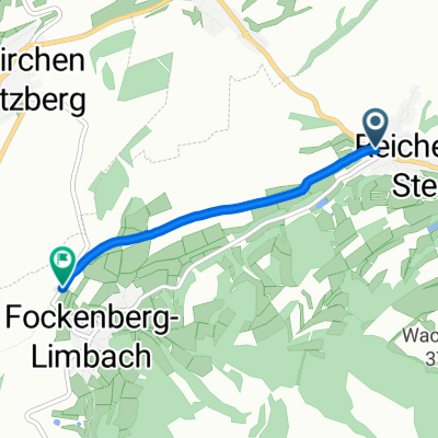
- Route nach Am Wingertsberg 15, Niederstaufenbach
- Distance
- 8.9 km
- Ascent
- 71 m
- Descent
- 245 m
- Location
- Oberstaufenbach, Rhineland-Palatinate, Germany
- L367 96, Reichenbach-Steegen nach Schulstraße 6, Reichenbach-Steegen
- Distance
- 44.2 km
- Ascent
- 927 m
- Descent
- 918 m
- Location
- Oberstaufenbach, Rhineland-Palatinate, Germany
- Recovered Route
- Distance
- 1.1 km
- Ascent
- 60 m
- Descent
- 14 m
- Location
- Oberstaufenbach, Rhineland-Palatinate, Germany