
Cycling in Ober-Flörsheim
Discover a map of 17 cycling routes and bike trails near Ober-Flörsheim, created by our community.
Region portrait
Get to know Ober-Flörsheim
Find the right bike route for you through Ober-Flörsheim, where we've got 17 cycle routes to explore.
741 km
Tracked distance
17
Cycle routes
1,187
Population
Community
Most active users in Ober-Flörsheim


From our community
The best bike routes in and around Ober-Flörsheim

Grundlage
Cycling route in Ober-Flörsheim, Rhineland-Palatinate, Germany
- 61.2 km
- Distance
- 550 m
- Ascent
- 584 m
- Descent
Weedegasse nach Soonwaldstraße
Cycling route in Ober-Flörsheim, Rhineland-Palatinate, Germany
- 81.7 km
- Distance
- 1,067 m
- Ascent
- 848 m
- Descent

Zellertal
Cycling route in Ober-Flörsheim, Rhineland-Palatinate, Germany
- 65.5 km
- Distance
- 541 m
- Ascent
- 541 m
- Descent
Walterplatz nach Speckerbrücke
Cycling route in Ober-Flörsheim, Rhineland-Palatinate, Germany
- 43.1 km
- Distance
- 518 m
- Ascent
- 657 m
- Descent
Discover more routes
 Kirschgartenstraße 10A, Ober-Flörsheim nach Am Schlosspark 14, Alzey
- Distance
- 11.6 km
- Ascent
- 87 m
- Descent
- 169 m
- Location
- Ober-Flörsheim, Rhineland-Palatinate, Germany
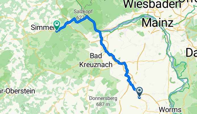
 Ober-Flörsheim -> Mainz
- Distance
- 46.1 km
- Ascent
- 245 m
- Descent
- 397 m
- Location
- Ober-Flörsheim, Rhineland-Palatinate, Germany
 Alzeyer Straße 72, Ober-Flörsheim nach Hüttenstraße 33 A, Worms
- Distance
- 22.1 km
- Ascent
- 41 m
- Descent
- 209 m
- Location
- Ober-Flörsheim, Rhineland-Palatinate, Germany
 Route von Außerhalb 10, Ober-Flörsheim
- Distance
- 21.7 km
- Ascent
- 578 m
- Descent
- 652 m
- Location
- Ober-Flörsheim, Rhineland-Palatinate, Germany
 O Flö nach Globus Grünstadt
- Distance
- 17.4 km
- Ascent
- 153 m
- Descent
- 255 m
- Location
- Ober-Flörsheim, Rhineland-Palatinate, Germany
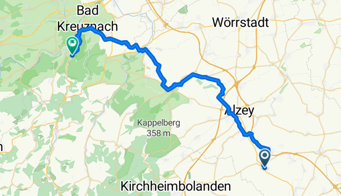
 Rheinhessen
- Distance
- 100.9 km
- Ascent
- 607 m
- Descent
- 642 m
- Location
- Ober-Flörsheim, Rhineland-Palatinate, Germany
 Mountainbike
- Distance
- 106.3 km
- Ascent
- 1,053 m
- Descent
- 1,066 m
- Location
- Ober-Flörsheim, Rhineland-Palatinate, Germany
 KIBO
KIBO- Distance
- 25.4 km
- Ascent
- 213 m
- Descent
- 213 m
- Location
- Ober-Flörsheim, Rhineland-Palatinate, Germany