
Cycling in Oberammergau
Discover a map of 349 cycling routes and bike trails near Oberammergau, created by our community.
Region portrait
Get to know Oberammergau
Find the right bike route for you through Oberammergau, where we've got 349 cycle routes to explore. Most people get on their bikes to ride here in the months of June and August.
23,094 km
Tracked distance
349
Cycle routes
5,344
Population
Handpicked routes
Discover Oberammergau through these collections
Tour
Tour
From our community
The best bike routes in and around Oberammergau

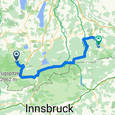
Ettaler Mandl - Drei-Marken
Cycling route in Oberammergau, Bavaria, Germany
Start in Oberammergau
Richtung Ettal nach weiter Richtung Eschenlohe
Weiter Richtung Grafenaschau (Pause)
Hoch zu den 3-Marken
Dann zur Romanshöhe und zurück
nach Oberammergau (Wellenberg) und zum Ausgangspunkt.
- 42.8 km
- Distance
- 1,071 m
- Ascent
- 1,068 m
- Descent

Ettaler Manndl Bike & Hike
Cycling route in Oberammergau, Bavaria, Germany
Letztes Stück Kletterei im Fels (Klettersteig bzw. Kette)
- 14.7 km
- Distance
- 803 m
- Ascent
- 803 m
- Descent

Ettal - Siller Berg - Großer Aufacker
Cycling route in Oberammergau, Bavaria, Germany
- 39.6 km
- Distance
- 1,358 m
- Ascent
- 1,418 m
- Descent

Discover more routes
 Pürschlinghaus
- Distance
- 15.9 km
- Ascent
- 714 m
- Descent
- 717 m
- Location
- Oberammergau, Bavaria, Germany
 Ettalermandl Tour
- Distance
- 43.7 km
- Ascent
- 385 m
- Descent
- 382 m
- Location
- Oberammergau, Bavaria, Germany
 TAC 2012 Etappe 1: Oberammgergau-Imst
- Distance
- 95.3 km
- Ascent
- 1,619 m
- Descent
- 1,673 m
- Location
- Oberammergau, Bavaria, Germany
 Unternogg
- Distance
- 10.6 km
- Ascent
- 69 m
- Descent
- 69 m
- Location
- Oberammergau, Bavaria, Germany
 Bayerntour 2009 Etappe 2
- Distance
- 111.2 km
- Ascent
- 1,084 m
- Descent
- 1,162 m
- Location
- Oberammergau, Bavaria, Germany
 Von Oberammergau nach Fürstenfeldbruck/Schöngeising
- Distance
- 92 km
- Ascent
- 349 m
- Descent
- 647 m
- Location
- Oberammergau, Bavaria, Germany
 Oberammergauer Höhenrunde
- Distance
- 42 km
- Ascent
- 1,023 m
- Descent
- 1,023 m
- Location
- Oberammergau, Bavaria, Germany
 Auf den Pürschling bei Oberammergau
- Distance
- 13 km
- Ascent
- 785 m
- Descent
- 787 m
- Location
- Oberammergau, Bavaria, Germany