
Cycling in Aschau im Chiemgau
Discover a map of 295 cycling routes and bike trails near Aschau im Chiemgau, created by our community.
Region portrait
Get to know Aschau im Chiemgau
Find the right bike route for you through Aschau im Chiemgau, where we've got 295 cycle routes to explore. Most people get on their bikes to ride here in the months of July and August.
13,403 km
Tracked distance
295
Cycle routes
5,410
Population
Community
Most active users in Aschau im Chiemgau


From our community
The best bike routes in and around Aschau im Chiemgau

Aschau-Wössnersee-Runde
Cycling route in Aschau im Chiemgau, Bavaria, Germany
- 53.1 km
- Distance
- 295 m
- Ascent
- 303 m
- Descent


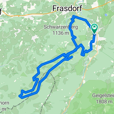
Chiemgau: Frasdorf-Hochries
Cycling route in Aschau im Chiemgau, Bavaria, Germany
- 34.9 km
- Distance
- 1,180 m
- Ascent
- 1,180 m
- Descent

Kampenwand
Cycling route in Aschau im Chiemgau, Bavaria, Germany
Versuch 1
- 16.9 km
- Distance
- 969 m
- Ascent
- 970 m
- Descent
Discover more routes
 aschau loop
- Distance
- 14.8 km
- Ascent
- 495 m
- Descent
- 490 m
- Location
- Aschau im Chiemgau, Bavaria, Germany
 GPX Download: Kampenwand-Umrundung (MTB-Tour: 3) – Chiemgauer Alpen
- Distance
- 84.5 km
- Ascent
- 4,639 m
- Descent
- 4,250 m
- Location
- Aschau im Chiemgau, Bavaria, Germany
 Hochries Umrundung
- Distance
- 36.1 km
- Ascent
- 1,229 m
- Descent
- 1,229 m
- Location
- Aschau im Chiemgau, Bavaria, Germany
 Kitzbüheler Horn
- Distance
- 130.3 km
- Ascent
- 1,707 m
- Descent
- 1,707 m
- Location
- Aschau im Chiemgau, Bavaria, Germany
 Transalp 2018
- Distance
- 500.6 km
- Ascent
- 5,688 m
- Descent
- 6,242 m
- Location
- Aschau im Chiemgau, Bavaria, Germany
 Schachenberg
- Distance
- 4.4 km
- Ascent
- 379 m
- Descent
- 376 m
- Location
- Aschau im Chiemgau, Bavaria, Germany
 Rund um den Geigelstein
- Distance
- 41.4 km
- Ascent
- 838 m
- Descent
- 838 m
- Location
- Aschau im Chiemgau, Bavaria, Germany
 Sudelfeldpass
- Distance
- 98.3 km
- Ascent
- 1,405 m
- Descent
- 1,405 m
- Location
- Aschau im Chiemgau, Bavaria, Germany
Routes to Aschau im Chiemgau
Quick ride by bicycle from
Bernau am Chiemsee to Aschau im Chiemgau