
Cycling in Naunheim
Discover a map of 4 cycling routes and bike trails near Naunheim, created by our community.
Be a pioneer
Inspire fellow cyclists with your route in Naunheim
Bikemap is a global cycling community with millions of routes created by cyclists like you. There are only a few routes so far in Naunheim, so plot your favourite rides on the map now to help others find the best ways to ride.
From our community
The best bike routes in and around Naunheim

Naunheim, Schrumpftal, Treis-Karden, Niederfell, Dreckenach, Naunheim
Cycling route in Naunheim, Rhineland-Palatinate, Germany
- 58.7 km
- Distance
- 358 m
- Ascent
- 350 m
- Descent
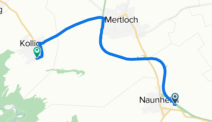
Radweg Naunheim - Mayen
Cycling route in Naunheim, Rhineland-Palatinate, Germany
Von Naunheim aus geht es in Richtung Mertloch, vorbei an Polch, hindurch durch die alten Tunnel. Nach dem Äquadukt beginnt der leichte Anstieg bis zur Abzweigung Hausen und dann endet der Radweg auf dem Mayener Katzenberg.
- 15.1 km
- Distance
- 196 m
- Ascent
- 155 m
- Descent

Rundweg IV Naunheim Mosel
Cycling route in Naunheim, Rhineland-Palatinate, Germany
- 27.6 km
- Distance
- 409 m
- Ascent
- 409 m
- Descent
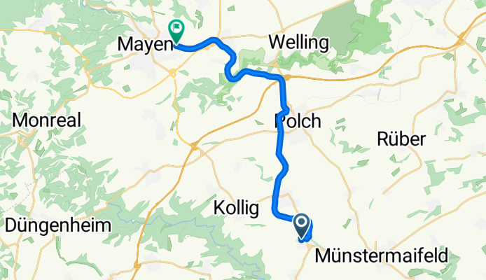
Am Bahnhof 1–3, Naunheim nach St-Willibrord-Straße 8, Kollig
Cycling route in Naunheim, Rhineland-Palatinate, Germany
- 5.4 km
- Distance
- 104 m
- Ascent
- 12 m
- Descent