
Cycling in Malschwitz
Discover a map of 55 cycling routes and bike trails near Malschwitz, created by our community.
Region portrait
Get to know Malschwitz
Find the right bike route for you through Malschwitz, where we've got 55 cycle routes to explore. Most people get on their bikes to ride here in the months of July and August.
2,384 km
Tracked distance
55
Cycle routes
3,800
Population


From our community
The best bike routes in and around Malschwitz


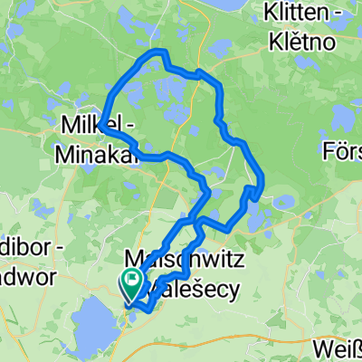
Teiche, Heide, Wälder und noch mehr Teiche
Cycling route in Malschwitz, Saxony, Germany
- 61.4 km
- Distance
- 143 m
- Ascent
- 147 m
- Descent


Teiche, Heide, Wälder und noch mehr Teiche; Variante II
Cycling route in Malschwitz, Saxony, Germany
- 65.8 km
- Distance
- 173 m
- Ascent
- 176 m
- Descent


Teiche, Wälder, Hügel …
Cycling route in Malschwitz, Saxony, Germany
- 60.1 km
- Distance
- 259 m
- Ascent
- 262 m
- Descent


Oberlausitzer Panoramatour 1.0
Cycling route in Malschwitz, Saxony, Germany
- 62.3 km
- Distance
- 346 m
- Ascent
- 349 m
- Descent
Discover more routes
 Oberlausitzer Bergland und Heide-/Teichlandschaft
- Distance
- 60.6 km
- Ascent
- 268 m
- Descent
- 272 m
- Location
- Malschwitz, Saxony, Germany
 Bautzner Teiche 11.6.18
- Distance
- 35.3 km
- Ascent
- 71 m
- Descent
- 67 m
- Location
- Malschwitz, Saxony, Germany
 Olba, Malschwitz, Guttau
- Distance
- 25.3 km
- Ascent
- 85 m
- Descent
- 86 m
- Location
- Malschwitz, Saxony, Germany
 Kleiner Frosch
- Distance
- 44.3 km
- Ascent
- 83 m
- Descent
- 86 m
- Location
- Malschwitz, Saxony, Germany
 RundumTour Malschwitz 2024
- Distance
- 43.5 km
- Ascent
- 133 m
- Descent
- 133 m
- Location
- Malschwitz, Saxony, Germany
 Purschwitzer Straße 28, Malschwitz nach Purschwitzer Straße 28, Malschwitz
- Distance
- 42.4 km
- Ascent
- 92 m
- Descent
- 173 m
- Location
- Malschwitz, Saxony, Germany
 Bärwalder See und Oberlausitzer Heide- und Teichlandschaft
- Distance
- 59.5 km
- Ascent
- 121 m
- Descent
- 124 m
- Location
- Malschwitz, Saxony, Germany
 Bautzen rund um den See
- Distance
- 16 km
- Ascent
- 152 m
- Descent
- 157 m
- Location
- Malschwitz, Saxony, Germany