
Cycling in Königsbronn
Discover a map of 214 cycling routes and bike trails near Königsbronn, created by our community.
Region portrait
Get to know Königsbronn
Find the right bike route for you through Königsbronn, where we've got 214 cycle routes to explore. Most people get on their bikes to ride here in the months of June and August.
7,313 km
Tracked distance
214
Cycle routes
7,420
Population
Community
Most active users in Königsbronn


From our community
The best bike routes in and around Königsbronn

Brenz-Radrundweg_Königsbronn_Lauingen_Giengen 95km 310hm
Cycling route in Königsbronn, Baden-Wurttemberg, Germany
- 94.6 km
- Distance
- 161 m
- Ascent
- 198 m
- Descent

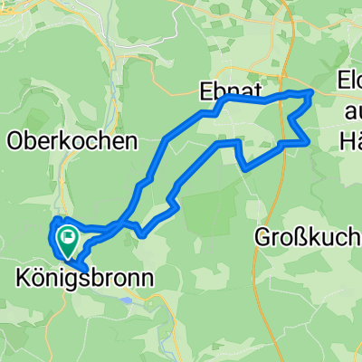
Königsbronn, Aalbäumle, Heide
Cycling route in Königsbronn, Baden-Wurttemberg, Germany
- 33 km
- Distance
- 612 m
- Ascent
- 612 m
- Descent

Heidenheim Itzelberg Relax
Cycling route in Königsbronn, Baden-Wurttemberg, Germany
- 9.2 km
- Distance
- 49 m
- Ascent
- 54 m
- Descent
Ziegelhütte - Weiherwiesen - Volkmasberg
Cycling route in Königsbronn, Baden-Wurttemberg, Germany
- 24.2 km
- Distance
- 377 m
- Ascent
- 395 m
- Descent
Discover more routes
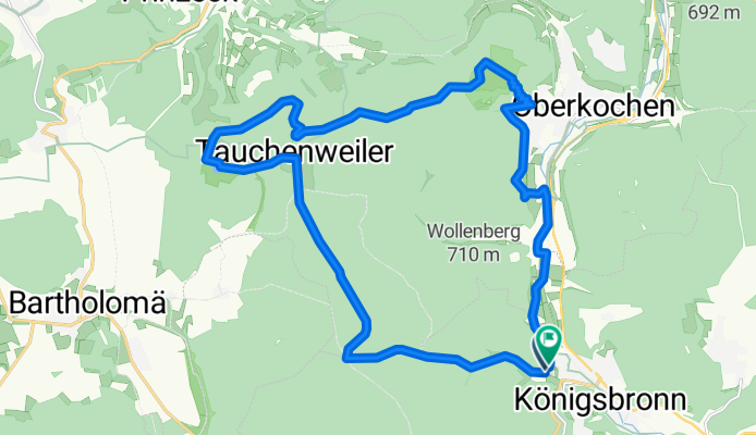
 Königsbronn- Tauchenweiler -Rosenstein
- Distance
- 23.5 km
- Ascent
- 667 m
- Descent
- 487 m
- Location
- Königsbronn, Baden-Wurttemberg, Germany
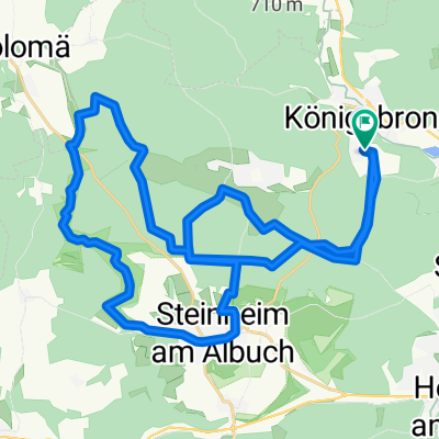
 Wiesenseen,Lauterburg, Wental, Steinheim, Königsbronn
- Distance
- 45 km
- Ascent
- 626 m
- Descent
- 626 m
- Location
- Königsbronn, Baden-Wurttemberg, Germany
 Volkmarsbergtour
- Distance
- 19.8 km
- Ascent
- 491 m
- Descent
- 372 m
- Location
- Königsbronn, Baden-Wurttemberg, Germany
 Königsbronn - Wental - Steinheim - Königsbronn
- Distance
- 34.8 km
- Ascent
- 385 m
- Descent
- 356 m
- Location
- Königsbronn, Baden-Wurttemberg, Germany
 Mitwoch-Abend-Tour 07.05.08
- Distance
- 30.2 km
- Ascent
- 294 m
- Descent
- 218 m
- Location
- Königsbronn, Baden-Wurttemberg, Germany
 Steinheim_Wental
- Distance
- 29.8 km
- Ascent
- 402 m
- Descent
- 377 m
- Location
- Königsbronn, Baden-Wurttemberg, Germany
 Wentaltour
- Distance
- 26.8 km
- Ascent
- 372 m
- Descent
- 372 m
- Location
- Königsbronn, Baden-Wurttemberg, Germany
 Moderate Route in Königsbronn - Schnaitheim
- Distance
- 15.2 km
- Ascent
- 146 m
- Descent
- 152 m
- Location
- Königsbronn, Baden-Wurttemberg, Germany