
Cycling in Gädheim
Discover a map of 112 cycling routes and bike trails near Gädheim, created by our community.
Region portrait
Get to know Gädheim
Find the right bike route for you through Gädheim, where we've got 112 cycle routes to explore. Most people get on their bikes to ride here in the months of May and July.
3,815 km
Tracked distance
112
Cycle routes

From our community
The best bike routes in and around Gädheim


Nürnberg - Koblenz Etappe 4/13
Cycling route in Gädheim, Bavaria, Germany
- 61.6 km
- Distance
- 151 m
- Ascent
- 194 m
- Descent
Discover more routes
 Vom Maintal in den Steigerwald
- Distance
- 52.3 km
- Ascent
- 359 m
- Descent
- 360 m
- Location
- Gädheim, Bavaria, Germany
 Von Ottendorf nach Limbach
- Distance
- 26.7 km
- Ascent
- 43 m
- Descent
- 50 m
- Location
- Gädheim, Bavaria, Germany
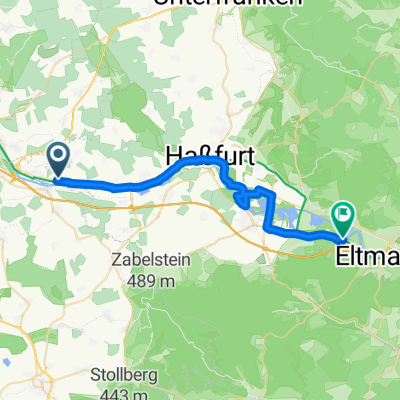
 Brief bike tour through the windmills
- Distance
- 7.1 km
- Ascent
- 96 m
- Descent
- 96 m
- Location
- Gädheim, Bavaria, Germany
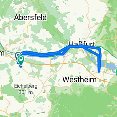 sonntagsroute
- Distance
- 38.4 km
- Ascent
- 229 m
- Descent
- 225 m
- Location
- Gädheim, Bavaria, Germany
 Gädheim Untertheres
- Distance
- 8.3 km
- Ascent
- 85 m
- Descent
- 148 m
- Location
- Gädheim, Bavaria, Germany
 Einfache Fahrt in
- Distance
- 14.8 km
- Ascent
- 176 m
- Descent
- 176 m
- Location
- Gädheim, Bavaria, Germany
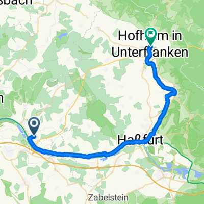 Wiesenstraße 5, Schonungen nach Ringstraße 2–4, Hofheim in Unterfranken
- Distance
- 32.8 km
- Ascent
- 191 m
- Descent
- 189 m
- Location
- Gädheim, Bavaria, Germany
 Langsame Fahrt in
- Distance
- 31.1 km
- Ascent
- 102 m
- Descent
- 107 m
- Location
- Gädheim, Bavaria, Germany