
Cycling in Forchtenberg
Discover a map of 145 cycling routes and bike trails near Forchtenberg, created by our community.
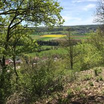
Region portrait
Get to know Forchtenberg
Find the right bike route for you through Forchtenberg, where we've got 145 cycle routes to explore. Most people get on their bikes to ride here in the months of May and July.
5,015 km
Tracked distance
145
Cycle routes
5,105
Population
Community
Most active users in Forchtenberg


From our community
The best bike routes in and around Forchtenberg


vom Kochertal durch Hardthäuser Wald nach Widdern und über Jagsthausen zurück
Cycling route in Forchtenberg, Baden-Wurttemberg, Germany
- 30.6 km
- Distance
- 426 m
- Ascent
- 402 m
- Descent
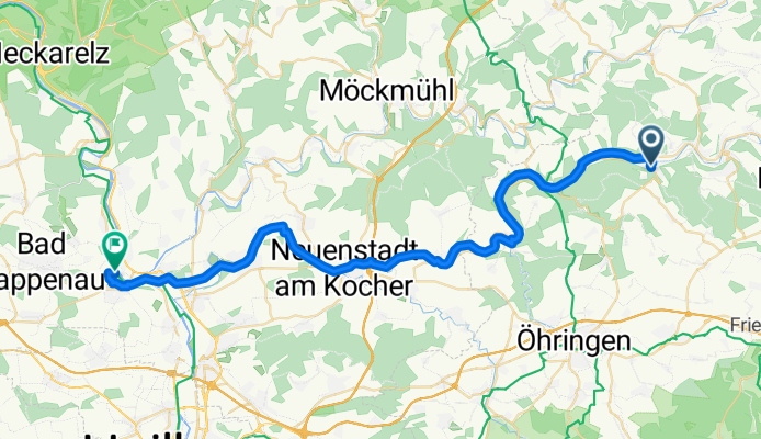
Forchtenberg - Bad Wimpfen 43km
Cycling route in Forchtenberg, Baden-Wurttemberg, Germany
- 42.7 km
- Distance
- 409 m
- Ascent
- 413 m
- Descent


Ernsbach, Klosterwald, Hohe Straße, Bobachshof, Crispenhofen, Weißbach, Büschelfof, Forchtenberg
Cycling route in Forchtenberg, Baden-Wurttemberg, Germany
- 38.4 km
- Distance
- 595 m
- Ascent
- 593 m
- Descent

Mühlweg, Forchtenberg nach Döttinger Straße, Braunsbach
Cycling route in Forchtenberg, Baden-Wurttemberg, Germany
- 28.5 km
- Distance
- 535 m
- Ascent
- 481 m
- Descent
Discover more routes
 Kocher-Jagst3, Forcht-berg-Bad Friedr.hall
- Distance
- 37.7 km
- Ascent
- 84 m
- Descent
- 120 m
- Location
- Forchtenberg, Baden-Wurttemberg, Germany
 Samstag Durchdrehrunde mir einigen HM
- Distance
- 77.4 km
- Ascent
- 1,715 m
- Descent
- 1,693 m
- Location
- Forchtenberg, Baden-Wurttemberg, Germany
 Von Ernsbach über Westernhausen Richtung Bieringen und vom Kloster Schöntal zurück
- Distance
- 37.4 km
- Ascent
- 621 m
- Descent
- 617 m
- Location
- Forchtenberg, Baden-Wurttemberg, Germany
 Trainingsrunde Kochertalexpress
- Distance
- 39.9 km
- Ascent
- 522 m
- Descent
- 522 m
- Location
- Forchtenberg, Baden-Wurttemberg, Germany
 Forchtenberg- Jagst-Kocher Radweg
- Distance
- 79.4 km
- Ascent
- 393 m
- Descent
- 408 m
- Location
- Forchtenberg, Baden-Wurttemberg, Germany
 Recovered Route
- Distance
- 18 km
- Ascent
- 25 m
- Descent
- 27 m
- Location
- Forchtenberg, Baden-Wurttemberg, Germany
 von Ernsbach über Hohe Straße ins Sindelbachtal und zurück über Tiroler Seen
- Distance
- 39.5 km
- Ascent
- 544 m
- Descent
- 534 m
- Location
- Forchtenberg, Baden-Wurttemberg, Germany
 Forcht-Winterb
- Distance
- 77.3 km
- Ascent
- 866 m
- Descent
- 827 m
- Location
- Forchtenberg, Baden-Wurttemberg, Germany