
Cycling in Mi‘ilyā
Discover a map of 16 cycling routes and bike trails near Mi‘ilyā, created by our community.
Region portrait
Get to know Mi‘ilyā
Find the right bike route for you through Mi‘ilyā, where we've got 16 cycle routes to explore.
925 km
Tracked distance
16
Cycle routes
2,700
Population
From our community
The best bike routes in and around Mi‘ilyā
Day 1
Cycling route in Mi‘ilyā, Northern District, Israel
מחנה אימונים אילון - יום 1
- 122 km
- Distance
- 1,978 m
- Ascent
- 1,721 m
- Descent
day 1 Thursday 13.3.2014
Cycling route in Mi‘ilyā, Northern District, Israel
מחנה אימונים אילון יום 1
- 100.3 km
- Distance
- 1,621 m
- Ascent
- 1,633 m
- Descent
Day 3
Cycling route in Mi‘ilyā, Northern District, Israel
מחנה אימונים אילון - יום 3
- 127.2 km
- Distance
- 1,662 m
- Ascent
- 1,658 m
- Descent
סינגל יחיעם 23.4.14 קקל
Cycling route in Mi‘ilyā, Northern District, Israel
המסלול מתחיל בחניון השיירה, הנמצא בשוליים המערביים של יער יחיעם, כחצי ק"מ דרומית לצומת כברי, על כביש 70.
בנתיב הגעתון
המסלול מעגלי – אין בעיה להתחיל אותו מכל נקודה, אולם יש היגיון בלהתחיל בעלייה מתונה מאוד ולסיים בירידה, ככוונת המתכנן. השילוט בשטח משולב: לוחיות על גבי עמודי עץ וסימון בצבע על גבי בול
- 39.3 km
- Distance
- 739 m
- Ascent
- 741 m
- Descent
Discover more routes
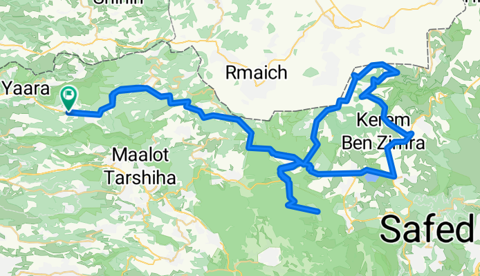
- אילון גורן נחל כזיב סיום בעבדון
- Distance
- 11 km
- Ascent
- 220 m
- Descent
- 359 m
- Location
- Mi‘ilyā, Northern District, Israel
- bike tour through Eilon
- Distance
- 29.8 km
- Ascent
- 631 m
- Descent
- 631 m
- Location
- Mi‘ilyā, Northern District, Israel
- 2200 סובב אילון
- Distance
- 94.2 km
- Ascent
- 1,725 m
- Descent
- 1,725 m
- Location
- Mi‘ilyā, Northern District, Israel
- Friday 14.3.2014
- Distance
- 111.7 km
- Ascent
- 1,698 m
- Descent
- 1,695 m
- Location
- Mi‘ilyā, Northern District, Israel
- אילון..כביש יערה. דרומה לאבדון, ירידה לנחל כזיב, מזרחה חזרה לגורן,עליה צפונה לאילון. 18.8 ק"מ
- Distance
- 18.9 km
- Ascent
- 360 m
- Descent
- 360 m
- Location
- Mi‘ilyā, Northern District, Israel
- אילון-אדמית-זרעית
- Distance
- 30.6 km
- Ascent
- 652 m
- Descent
- 643 m
- Location
- Mi‘ilyā, Northern District, Israel
- אילון דרך גורן, נחל בצת, סיום בעבדון
- Distance
- 128.7 km
- Ascent
- 498 m
- Descent
- 646 m
- Location
- Mi‘ilyā, Northern District, Israel
- Recovered Route
- Distance
- 5.8 km
- Ascent
- 37 m
- Descent
- 243 m
- Location
- Mi‘ilyā, Northern District, Israel