
Cycling in Stamullin
Discover a map of 13 cycling routes and bike trails near Stamullin, created by our community.
Region portrait
Get to know Stamullin
Find the right bike route for you through Stamullin, where we've got 13 cycle routes to explore.
369 km
Tracked distance
13
Cycle routes
3,130
Population
Community
Most active users in Stamullin


From our community
The best bike routes in and around Stamullin

1Gormanston to Mine Road 2, Loughshinny
Cycling route in Stamullin, Leinster, Ireland
- 17.6 km
- Distance
- 107 m
- Ascent
- 105 m
- Descent


Discover more routes
 route 1
- Distance
- 53.5 km
- Ascent
- 547 m
- Descent
- 544 m
- Location
- Stamullin, Leinster, Ireland
 home to train station
- Distance
- 11.9 km
- Ascent
- 78 m
- Descent
- 77 m
- Location
- Stamullin, Leinster, Ireland
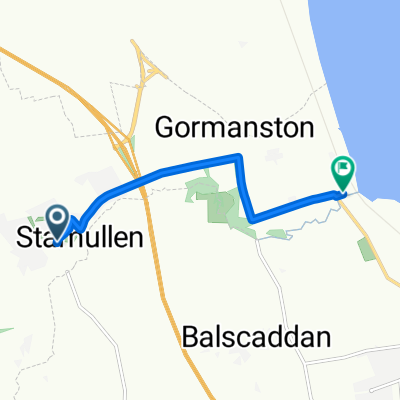 Orchard Vale, Stamullen to Silver Beach, Gormanston
- Distance
- 4.9 km
- Ascent
- 9 m
- Descent
- 34 m
- Location
- Stamullin, Leinster, Ireland
 Restful route
- Distance
- 1 km
- Ascent
- 63 m
- Descent
- 5 m
- Location
- Stamullin, Leinster, Ireland
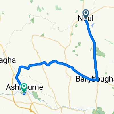 Main St, Naul to Greenfield Grove, Ashbourne
- Distance
- 22.4 km
- Ascent
- 168 m
- Descent
- 173 m
- Location
- Stamullin, Leinster, Ireland
 Route from 1–8 Orchard Vale, Stamullen
- Distance
- 11.8 km
- Ascent
- 80 m
- Descent
- 81 m
- Location
- Stamullin, Leinster, Ireland
 kilkenny
- Distance
- 157.3 km
- Ascent
- 816 m
- Descent
- 797 m
- Location
- Stamullin, Leinster, Ireland
 6 The Delvin Centre, Main St, Stamullen to 2 Terminal Complex, Swords
- Distance
- 26.3 km
- Ascent
- 211 m
- Descent
- 176 m
- Location
- Stamullin, Leinster, Ireland