
Cycling in Mount Merrion
Discover a map of 86 cycling routes and bike trails near Mount Merrion, created by our community.
Region portrait
Get to know Mount Merrion
Find the right bike route for you through Mount Merrion, where we've got 86 cycle routes to explore. Most people get on their bikes to ride here in the months of July and October.
4,254 km
Tracked distance
86
Cycle routes
7,846
Population
Community
Most active users in Mount Merrion


From our community
The best bike routes in and around Mount Merrion


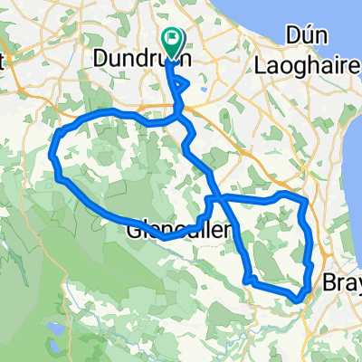
Goatstown to Killiney Head
Cycling route in Mount Merrion, Leinster, Ireland
- 11.3 km
- Distance
- 151 m
- Ascent
- 98 m
- Descent

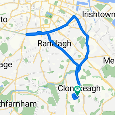
Seafield Crescent 77, Booterstown to Bellevue Park 1B, Booterstown
Cycling route in Mount Merrion, Leinster, Ireland
- 55.4 km
- Distance
- 507 m
- Ascent
- 509 m
- Descent

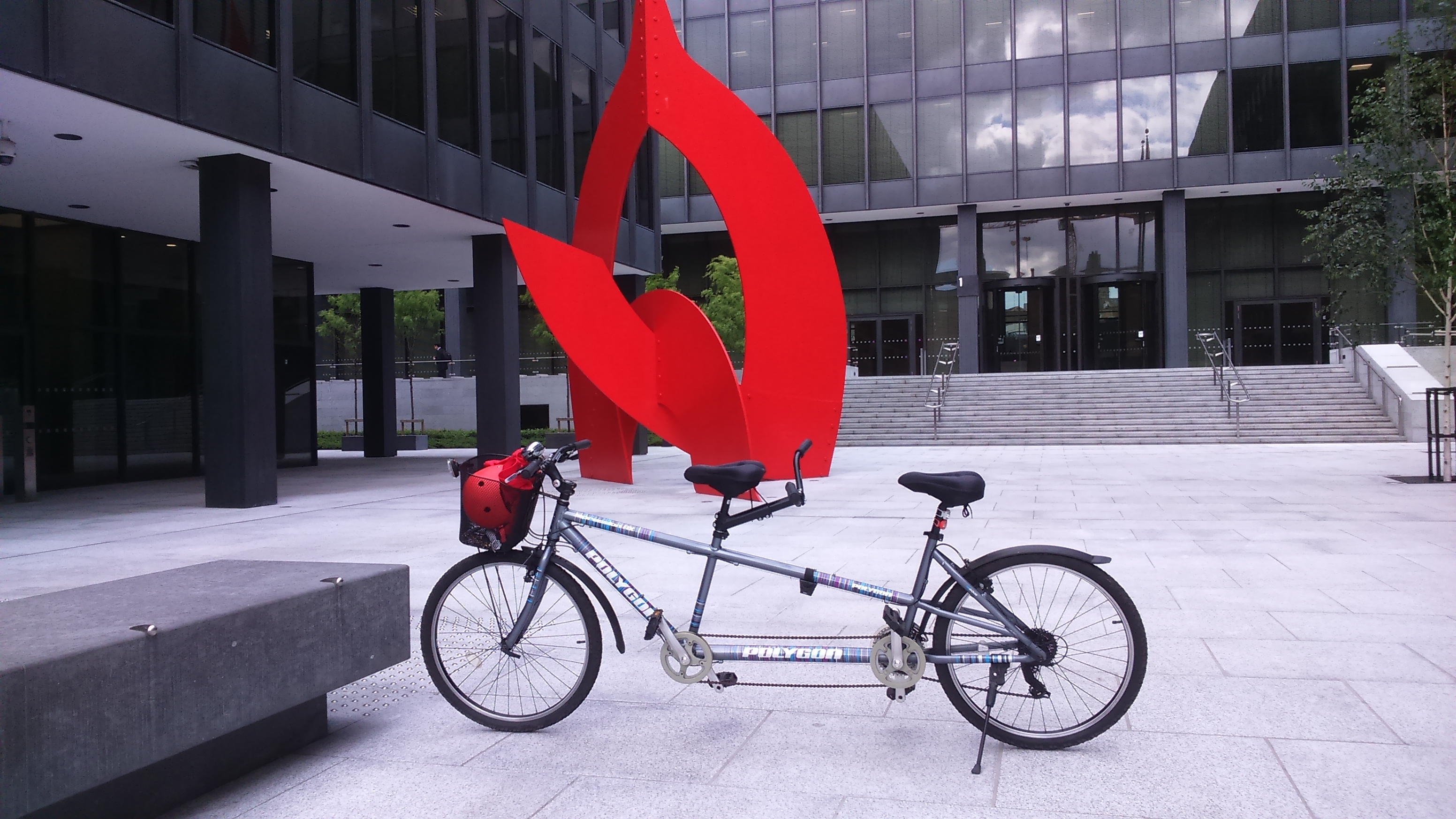

Tandem The Twin Towers
Cycling route in Mount Merrion, Leinster, Ireland
- 18.7 km
- Distance
- 279 m
- Ascent
- 280 m
- Descent
Discover more routes
 Coastal Route
- Distance
- 71 km
- Ascent
- 763 m
- Descent
- 760 m
- Location
- Mount Merrion, Leinster, Ireland
 Pine Forrest Road
- Distance
- 43.3 km
- Ascent
- 514 m
- Descent
- 512 m
- Location
- Mount Merrion, Leinster, Ireland
 Short Country Road Route
- Distance
- 34.8 km
- Ascent
- 446 m
- Descent
- 444 m
- Location
- Mount Merrion, Leinster, Ireland
 North & South Coast Route
- Distance
- 119.6 km
- Ascent
- 763 m
- Descent
- 763 m
- Location
- Mount Merrion, Leinster, Ireland
 36 Roebuck Road, Clonskeagh to 4–12 Roebuck Road, Clonskeagh
- Distance
- 0.3 km
- Ascent
- 0 m
- Descent
- 0 m
- Location
- Mount Merrion, Leinster, Ireland
 New Route
- Distance
- 42.5 km
- Ascent
- 585 m
- Descent
- 583 m
- Location
- Mount Merrion, Leinster, Ireland
 Lower Kilmacud Rd, stop 3021, Dublin to R825 217, Dublin
- Distance
- 123.4 km
- Ascent
- 2,899 m
- Descent
- 2,884 m
- Location
- Mount Merrion, Leinster, Ireland
 Canal ride
- Distance
- 13.1 km
- Ascent
- 352 m
- Descent
- 343 m
- Location
- Mount Merrion, Leinster, Ireland