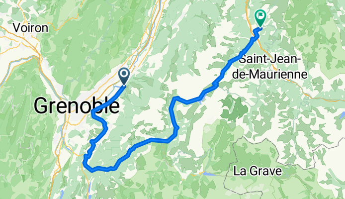
Cycling in Villard-Bonnot
Discover a map of 28 cycling routes and bike trails near Villard-Bonnot, created by our community.
Region portrait
Get to know Villard-Bonnot
Find the right bike route for you through Villard-Bonnot, where we've got 28 cycle routes to explore.
1,752 km
Tracked distance
28
Cycle routes
7,400
Population
Community
Most active users in Villard-Bonnot
From our community
The best bike routes in and around Villard-Bonnot
Villard-Bonnot - Balcons Belledonne
Cycling route in Villard-Bonnot, Auvergne-Rhône-Alpes, France
Cols des Mouilles, Lautaret, Barioz, Colet Allevard
- 127.6 km
- Distance
- 2,636 m
- Ascent
- 2,634 m
- Descent
De Avenue des Papeteries 4, Villard-Bonnot à Avenue des Papeteries 4, Villard-Bonnot
Cycling route in Villard-Bonnot, Auvergne-Rhône-Alpes, France
- 51.3 km
- Distance
- 1,485 m
- Ascent
- 1,485 m
- Descent
Villard Bonnot-Italie 5 jours
Cycling route in Villard-Bonnot, Auvergne-Rhône-Alpes, France
Projet de parcours en 5 jours
Première nuit : Camping le Bois Joli 73130 Saint Martin sur la Chambre (tel. <span class="numero">09 66 97 21 28)</span>
Deuxième nuit : Bourg Saint-Maurice (<span style="color: #000000;">Camping Le Reclus – 73700 SEEZ tel</span><span style="color: #000000;"><span style="color: #ff6600;"> 04 79 41 01 05</span></span>)<span style="color: #000000;"> ou SAN CASSIANO SRL - Loc. Thovex - Via dei Romani, 4 - La Salle (AO) - Tel./fax +39 0165 861300</span>
Troisième nuit : Camping Les Neuvilles Rte du Levant 68, 1920 Martigny (tel. +41 27 722 45 44)
ou Camping Les Deux Glacier, 80 Route des Tissières, 74400 Chamonix-Mont-Blanc, France<br />
Tél: 0450531584
Quatrième nuit : Camping Champ Tillet, 28 rue Chenevier, 74210 Marlens Tél : 04 50 44 33 74
- 558.2 km
- Distance
- 8,411 m
- Ascent
- 8,411 m
- Descent
COL DES MOUILLES PAR VILLARD BONNOT
Cycling route in Villard-Bonnot, Auvergne-Rhône-Alpes, France
- 9.8 km
- Distance
- 778 m
- Ascent
- 11 m
- Descent
Discover more routes
- Villard-Bonnot 1
- Distance
- 107 km
- Ascent
- 2,047 m
- Descent
- 1,717 m
- Location
- Villard-Bonnot, Auvergne-Rhône-Alpes, France
- Col de Pré Long
- Distance
- 12 km
- Ascent
- 999 m
- Descent
- 23 m
- Location
- Villard-Bonnot, Auvergne-Rhône-Alpes, France
- Lancey Corniches
- Distance
- 146.4 km
- Ascent
- 1,787 m
- Descent
- 1,791 m
- Location
- Villard-Bonnot, Auvergne-Rhône-Alpes, France
- Balcons de Belledonne
- Distance
- 82.5 km
- Ascent
- 1,776 m
- Descent
- 1,778 m
- Location
- Villard-Bonnot, Auvergne-Rhône-Alpes, France
- Quick bike tour through La-Combe-de-Lancey
- Distance
- 8.7 km
- Ascent
- 204 m
- Descent
- 207 m
- Location
- Villard-Bonnot, Auvergne-Rhône-Alpes, France
- De La ville 3, Sainte-Agnés à Boulevard Gaston Mollex 159, Brison-Saint-Innocent
- Distance
- 68.8 km
- Ascent
- 375 m
- Descent
- 847 m
- Location
- Villard-Bonnot, Auvergne-Rhône-Alpes, France
- 43 Impasse du Grand Joly, Sainte-Agnès à 43 Impasse du Grand Joly, Sainte-Agnès
- Distance
- 32.7 km
- Ascent
- 1,135 m
- Descent
- 1,135 m
- Location
- Villard-Bonnot, Auvergne-Rhône-Alpes, France
- 2385 Route du Col des Mouilles, Sainte-Agnès à 5 Sentier de la Bastille, Saint-Martin-le-Vinoux
- Distance
- 26.8 km
- Ascent
- 351 m
- Descent
- 788 m
- Location
- Villard-Bonnot, Auvergne-Rhône-Alpes, France