
Cycling in Saint-Satur
Discover a map of 63 cycling routes and bike trails near Saint-Satur, created by our community.
Region portrait
Get to know Saint-Satur
Find the right bike route for you through Saint-Satur, where we've got 63 cycle routes to explore. Most people get on their bikes to ride here in the month of August.
4,507 km
Tracked distance
63
Cycle routes
1,789
Population
Community
Most active users in Saint-Satur


From our community
The best bike routes in and around Saint-Satur

Sancerre 108KM d+ 1610 (en passant par Borne et Humbligny )
Cycling route in Saint-Satur, Centre Region, France
None (cloned from route 1499517)
- 108.5 km
- Distance
- 1,119 m
- Ascent
- 1,119 m
- Descent

LV13 St Thibault (Sancerre) to Briare.kml - LV13 St Thibault (Sancerre) to Briare.kml_LV13 St Thibault (Sancerre) to Briare
Cycling route in Saint-Satur, Centre Region, France
Converted from a KML file KML2GPX.COM - This is track no: 1
- 43.2 km
- Distance
- 111 m
- Ascent
- 125 m
- Descent

rando sancerre pouilly
Cycling route in Saint-Satur, Centre Region, France
- 51.7 km
- Distance
- 419 m
- Ascent
- 431 m
- Descent

depart sancerre
Cycling route in Saint-Satur, Centre Region, France
etape 1 champvert 96 km
etape 2 la clayette 111 km
etape 3 lyon 83 km
etape 4 marcigny 95 km
etape 5 le veurdre 100
etape 6 et 7 orleans 100 + 100
etape 3
- 716.6 km
- Distance
- 1,312 m
- Ascent
- 1,389 m
- Descent
Discover more routes
 Saint satur-Thauvenay-Recy- Saint Bouize-Saint Satur
- Distance
- 27.4 km
- Ascent
- 122 m
- Descent
- 122 m
- Location
- Saint-Satur, Centre Region, France
 EU 24 _ Saint Satur - Nevers _ 69 km
- Distance
- 69 km
- Ascent
- 74 m
- Descent
- 30 m
- Location
- Saint-Satur, Centre Region, France
 De Les Godibolles 1024, Saint-Satur à Route de Jargeau 1, Darvoy
- Distance
- 115.3 km
- Ascent
- 368 m
- Descent
- 415 m
- Location
- Saint-Satur, Centre Region, France
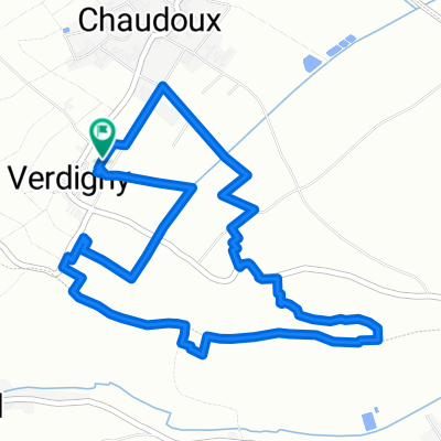 8 heures de Verdigny 2011
- Distance
- 5.9 km
- Ascent
- 78 m
- Descent
- 79 m
- Location
- Saint-Satur, Centre Region, France
 Saint Satur - Bannay - Lere - Boulleret - Saint Satur
- Distance
- 44.2 km
- Ascent
- 89 m
- Descent
- 89 m
- Location
- Saint-Satur, Centre Region, France
 2013 day one
- Distance
- 69.5 km
- Ascent
- 182 m
- Descent
- 246 m
- Location
- Saint-Satur, Centre Region, France
 St Satu to Aubigny
- Distance
- 41 km
- Ascent
- 334 m
- Descent
- 294 m
- Location
- Saint-Satur, Centre Region, France
 Sancerre - Beaulieu -St Fargeau - Gédelon - Sancerre
- Distance
- 90.8 km
- Ascent
- 315 m
- Descent
- 253 m
- Location
- Saint-Satur, Centre Region, France