Cycling in Saint-Michel-de-Maurienne
Discover a map of 481 cycling routes and bike trails near Saint-Michel-de-Maurienne, created by our community.
Region portrait
Get to know Saint-Michel-de-Maurienne
Find the right bike route for you through Saint-Michel-de-Maurienne, where we've got 481 cycle routes to explore. Most people get on their bikes to ride here in the months of July and August.
52,774 km
Tracked distance
481
Cycle routes
3,174
Population
Community
Most active users in Saint-Michel-de-Maurienne
From our community
The best bike routes in and around Saint-Michel-de-Maurienne
COLL D´ ISERAN
Cycling route in Saint-Michel-de-Maurienne, Auvergne-Rhône-Alpes, France
- 73.6 km
- Distance
- 2,202 m
- Ascent
- 153 m
- Descent
MONTVERNIER - TOUSSUIRE
Cycling route in Saint-Michel-de-Maurienne, Auvergne-Rhône-Alpes, France
- 106.3 km
- Distance
- 2,414 m
- Ascent
- 2,414 m
- Descent
Alpentour 2008
Cycling route in Saint-Michel-de-Maurienne, Auvergne-Rhône-Alpes, France
- 80.9 km
- Distance
- 3,097 m
- Ascent
- 3,082 m
- Descent
CROIX DE FER
Cycling route in Saint-Michel-de-Maurienne, Auvergne-Rhône-Alpes, France
- 63.9 km
- Distance
- 2,571 m
- Ascent
- 2,571 m
- Descent
Discover more routes
 Telegraphe - Galibier
- Distance
- 64.7 km
- Ascent
- 2,218 m
- Descent
- 1,565 m
- Location
- Saint-Michel-de-Maurienne, Auvergne-Rhône-Alpes, France
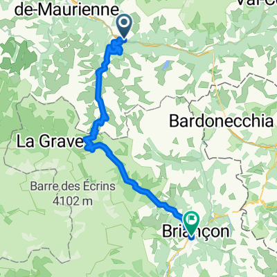
 FA08 Briancon
- Distance
- 69.2 km
- Ascent
- 2,096 m
- Descent
- 1,479 m
- Location
- Saint-Michel-de-Maurienne, Auvergne-Rhône-Alpes, France
 Frankreich 2.0 Über den Télégraphe auf den Galibier
- Distance
- 33.8 km
- Ascent
- 1,742 m
- Descent
- 163 m
- Location
- Saint-Michel-de-Maurienne, Auvergne-Rhône-Alpes, France
 Stäfa - Tarifa Stage #5 Michel de Maurienne - Briancon
- Distance
- 64.5 km
- Ascent
- 2,020 m
- Descent
- 1,540 m
- Location
- Saint-Michel-de-Maurienne, Auvergne-Rhône-Alpes, France
 10 tappa traversata delle alpi
- Distance
- 75.7 km
- Ascent
- 2,092 m
- Descent
- 1,625 m
- Location
- Saint-Michel-de-Maurienne, Auvergne-Rhône-Alpes, France
 Radreise Ge-Nice-Ledro, St.-Michel-de-Maurienne - Briacon
- Distance
- 71.9 km
- Ascent
- 2,042 m
- Descent
- 1,465 m
- Location
- Saint-Michel-de-Maurienne, Auvergne-Rhône-Alpes, France
 Col de l´Iseran jižní stranou
- Distance
- 138.5 km
- Ascent
- 1,922 m
- Descent
- 1,987 m
- Location
- Saint-Michel-de-Maurienne, Auvergne-Rhône-Alpes, France
 Tour des Irons 1: Telegraph to Alpe d'Huez
- Distance
- 82.4 km
- Ascent
- 2,283 m
- Descent
- 2,288 m
- Location
- Saint-Michel-de-Maurienne, Auvergne-Rhône-Alpes, France
Routes from Saint-Michel-de-Maurienne
Cycling day trip from
Saint-Michel-de-Maurienne to Huez
Cycling day trip from
Saint-Michel-de-Maurienne to Briançon
By bicycle from
Saint-Michel-de-Maurienne to Valloire
Routes to Saint-Michel-de-Maurienne
Cycling day trip from
Bourg-Saint-Maurice to Saint-Michel-de-Maurienne
Cycling day trip from
Huez to Saint-Michel-de-Maurienne


