
Cycling in Saint-Michel-Chef-Chef
Discover a map of 95 cycling routes and bike trails near Saint-Michel-Chef-Chef, created by our community.
Region portrait
Get to know Saint-Michel-Chef-Chef
Find the right bike route for you through Saint-Michel-Chef-Chef, where we've got 95 cycle routes to explore. Most people get on their bikes to ride here in the months of June and August.
5,298 km
Tracked distance
95
Cycle routes
3,435
Population
Community
Most active users in Saint-Michel-Chef-Chef


From our community
The best bike routes in and around Saint-Michel-Chef-Chef

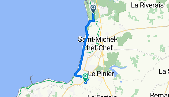
De Chemin du Bréneau, Saint-Brevin-les-Pins à 16 Avenue de la Botte, La Plaine-sur-Mer
Cycling route in Saint-Michel-Chef-Chef, Pays de la Loire Region, France
- 7.1 km
- Distance
- 4 m
- Ascent
- 17 m
- Descent

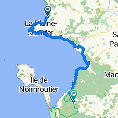
PB ST6
Cycling route in Saint-Michel-Chef-Chef, Pays de la Loire Region, France
- 95.5 km
- Distance
- 76 m
- Ascent
- 75 m
- Descent

Atlantikroute - Etappe 2
Cycling route in Saint-Michel-Chef-Chef, Pays de la Loire Region, France
- 44.9 km
- Distance
- 160 m
- Ascent
- 160 m
- Descent

Saint-Brevin / Saint-Hilaire de Riez
Cycling route in Saint-Michel-Chef-Chef, Pays de la Loire Region, France
- 130.7 km
- Distance
- 395 m
- Ascent
- 412 m
- Descent
Discover more routes
 46 Avenue des Sports, Saint-Michel-Chef-Chef à 8 Rue du Bel Essor, Saint-Michel-Chef-Chef
- Distance
- 45.6 km
- Ascent
- 299 m
- Descent
- 306 m
- Location
- Saint-Michel-Chef-Chef, Pays de la Loire Region, France
 Marty - Day 5
- Distance
- 85.3 km
- Ascent
- 285 m
- Descent
- 301 m
- Location
- Saint-Michel-Chef-Chef, Pays de la Loire Region, France
 07- Saint Michel Chef Chef / Migron
- Distance
- 39.4 km
- Ascent
- 50 m
- Descent
- 74 m
- Location
- Saint-Michel-Chef-Chef, Pays de la Loire Region, France
 9. Saint-Michel-Chef-Chef - Saint-Urbain
- Distance
- 78.7 km
- Ascent
- 0 m
- Descent
- 0 m
- Location
- Saint-Michel-Chef-Chef, Pays de la Loire Region, France
 40 Rue de Tharon, Saint-Michel-Chef-Chef à 8 Rue du Bel Essor, Saint-Michel-Chef-Chef
- Distance
- 33.7 km
- Ascent
- 221 m
- Descent
- 220 m
- Location
- Saint-Michel-Chef-Chef, Pays de la Loire Region, France
 Voyage rapide St Michel - Préfailles
- Distance
- 8.8 km
- Ascent
- 52 m
- Descent
- 53 m
- Location
- Saint-Michel-Chef-Chef, Pays de la Loire Region, France
 Itinéraire modéré en Pornic
- Distance
- 11.1 km
- Ascent
- 76 m
- Descent
- 87 m
- Location
- Saint-Michel-Chef-Chef, Pays de la Loire Region, France
 Von Saint-Michel-Chef-Chef bis Beauvoir-sur-Mer
- Distance
- 66.2 km
- Ascent
- 276 m
- Descent
- 293 m
- Location
- Saint-Michel-Chef-Chef, Pays de la Loire Region, France