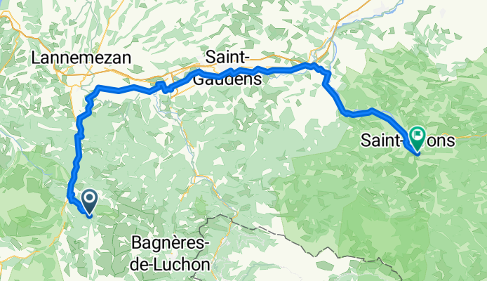
- 144.1 km
- 0 m
- 0 m
- Saint-Lary-Soulan, Occitanie, France

Cycling in Saint-Lary-Soulan
Discover a map of 1,165 cycling routes and bike trails near Saint-Lary-Soulan, created by our community.
Region portrait
Get to know Saint-Lary-Soulan
Find the right bike route for you through Saint-Lary-Soulan, where we've got 1,165 cycle routes to explore. Most people get on their bikes to ride here in the months of July and August.
95,676 km
Tracked distance
1,165
Cycle routes
1,068
Population
Community
Most active users in Saint-Lary-Soulan
Handpicked routes
Discover Saint-Lary-Soulan through these collections
- Tour
 Tour
Tour Tour
Tour Tour
Tour
From our community
The best bike routes in and around Saint-Lary-Soulan
Saint-Lary-Soulan - Saint-Girons
Cycling route in Saint-Lary-Soulan, Occitanie, France
- 118.8 km
- Distance
- 1,552 m
- Ascent
- 2,016 m
- Descent
5 Estarvielle - Llavorsi
Cycling route in Saint-Lary-Soulan, Occitanie, France
- 115.7 km
- Distance
- 2,574 m
- Ascent
- 2,724 m
- Descent
Sait Lary Soulan-Col d´Azet-Col de Peyresourde-Bagnerés de Luchon-Col du Portillon-Arties
Cycling route in Saint-Lary-Soulan, Occitanie, France
- 86 km
- Distance
- 2,487 m
- Ascent
- 2,163 m
- Descent
11.08.07 Col de Peyresourde
Cycling route in Saint-Lary-Soulan, Occitanie, France
- 51.2 km
- Distance
- 1,051 m
- Ascent
- 1,051 m
- Descent
Discover more routes
- Etapa 1 Pirineos 2013 (144kms)
- Azet-Pla d'Adet
- 64.4 km
- 1,747 m
- 1,744 m
- Saint-Lary-Soulan, Occitanie, France
- V12 Lac d'Aumar i Lac d Cap d Llong
- 34.9 km
- 1,732 m
- 384 m
- Saint-Lary-Soulan, Occitanie, France
- TDP - ETAPE 8
- 43.2 km
- 831 m
- 1,113 m
- Saint-Lary-Soulan, Occitanie, France
- F-Pyr-Arreau-112 2400
- 110.2 km
- 2,055 m
- 2,055 m
- Saint-Lary-Soulan, Occitanie, France
- Saint-Lary-Soulan - Castillon-en-Couserans
- 188.9 km
- 3,823 m
- 4,026 m
- Saint-Lary-Soulan, Occitanie, France
- Pla d'Adet
- 12.1 km
- 1,046 m
- 207 m
- Saint-Lary-Soulan, Occitanie, France
- Saint Lary-Col du Portet-Saint Lary
- 34.9 km
- 1,420 m
- 1,420 m
- Saint-Lary-Soulan, Occitanie, France
Routes from Saint-Lary-Soulan
Bikepacking from
Saint-Lary-Soulan to Saint-Girons
Cycling day trip from
Saint-Lary-Soulan to Argelès-Gazost
Cycling day trip from
Saint-Lary-Soulan to Bagnères-de-Luchon
Routes to Saint-Lary-Soulan
Cycling day trip from
Luz-Saint-Sauveur to Saint-Lary-Soulan
Cycling day trip from
Argelès-Gazost to Saint-Lary-Soulan


