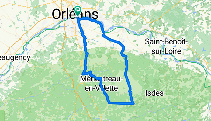
Cycling in Saint-Jean-le-Blanc
Discover a map of 347 cycling routes and bike trails near Saint-Jean-le-Blanc, created by our community.
Region portrait
Get to know Saint-Jean-le-Blanc
Find the right bike route for you through Saint-Jean-le-Blanc, where we've got 347 cycle routes to explore. Most people get on their bikes to ride here in the months of March and August.
31,358 km
Tracked distance
347
Cycle routes
9,025
Population
Community
Most active users in Saint-Jean-le-Blanc
From our community
The best bike routes in and around Saint-Jean-le-Blanc
Loire Radweg von Ost nach West
Cycling route in Saint-Jean-le-Blanc, Centre Region, France
Loire Radweg aus Bikeline Radführer
- 444.9 km
- Distance
- 150 m
- Ascent
- 242 m
- Descent
LOIRET - SO - 92km orleans
Cycling route in Saint-Jean-le-Blanc, Centre Region, France
sud- ouest orleans ---- Orléans - st hilaire - mézière - jouy - dir la ferté - à dr après autoroute - (pause km 35)-ligny - Monçay-lailly - dir beaugency - à dr dir dry - Villecante - dir Cléry - levée - st hilaire - orleans
- 91.6 km
- Distance
- 226 m
- Ascent
- 229 m
- Descent
LOIRET - SUD - 88 kms
Cycling route in Saint-Jean-le-Blanc, Centre Region, France
SUD ORLEANS --Denivelé :50m--88kms---levée de loire - sandillon--rte de férolle -vienne - (pause a la scierie) - sennely - souvigny en sologne - vouzon - menestreau - dir la ferté - retour par la za la saussaye- piste cyclabe - orleans
- 87.5 km
- Distance
- 260 m
- Ascent
- 260 m
- Descent
LOIRET - SO - 82km orleans
Cycling route in Saint-Jean-le-Blanc, Centre Region, France
sud- ouest orleans ---- Orléans - st hilaire - mézière - jouy - dir la ferté - à dr a-ligny - (pause km38,5) - Monçay-lailly - dir beaugency - à dr dir dry - Villecante - dir Cléry - levée - st hilaire - orleans
- 80.7 km
- Distance
- 189 m
- Ascent
- 192 m
- Descent
Discover more routes
 loiret - SO - 81kms
- Distance
- 81.2 km
- Ascent
- 217 m
- Descent
- 217 m
- Location
- Saint-Jean-le-Blanc, Centre Region, France
 LOIRET S-E ORLEANS 95km
- Distance
- 94.8 km
- Ascent
- 330 m
- Descent
- 329 m
- Location
- Saint-Jean-le-Blanc, Centre Region, France
 LOIRET - SUD ORLEANS-marcilly-ciran-la ferté-lailly-levée
- Distance
- 90.6 km
- Ascent
- 298 m
- Descent
- 298 m
- Location
- Saint-Jean-le-Blanc, Centre Region, France
 LOIRE - SO - orleans 110km
- Distance
- 109.4 km
- Ascent
- 319 m
- Descent
- 317 m
- Location
- Saint-Jean-le-Blanc, Centre Region, France
 LOIRET - SUD - 87KM - st cyr-marcilly-ménestreau- la ferté-ligny-jouy- ardon-st cyr
- Distance
- 86.5 km
- Ascent
- 325 m
- Descent
- 323 m
- Location
- Saint-Jean-le-Blanc, Centre Region, France
 LOIRET - SE - SO - 89KM - st denis en val st cyr -ardon -jouy-cléry-meung-huisseau-
- Distance
- 89.7 km
- Ascent
- 284 m
- Descent
- 282 m
- Location
- Saint-Jean-le-Blanc, Centre Region, France
 LOIRET S-E tigy petit parcours 83km
- Distance
- 83.5 km
- Ascent
- 301 m
- Descent
- 300 m
- Location
- Saint-Jean-le-Blanc, Centre Region, France
 LOIRET SO -110KM saran - gidy - beaugency
- Distance
- 109.8 km
- Ascent
- 262 m
- Descent
- 259 m
- Location
- Saint-Jean-le-Blanc, Centre Region, France


