
Cycling in Saint-Jean-Bonnefonds
Discover a map of 36 cycling routes and bike trails near Saint-Jean-Bonnefonds, created by our community.
Region portrait
Get to know Saint-Jean-Bonnefonds
Find the right bike route for you through Saint-Jean-Bonnefonds, where we've got 36 cycle routes to explore. Most people get on their bikes to ride here in the month of September.
1,134 km
Tracked distance
36
Cycle routes
6,076
Population
Community
Most active users in Saint-Jean-Bonnefonds


From our community
The best bike routes in and around Saint-Jean-Bonnefonds

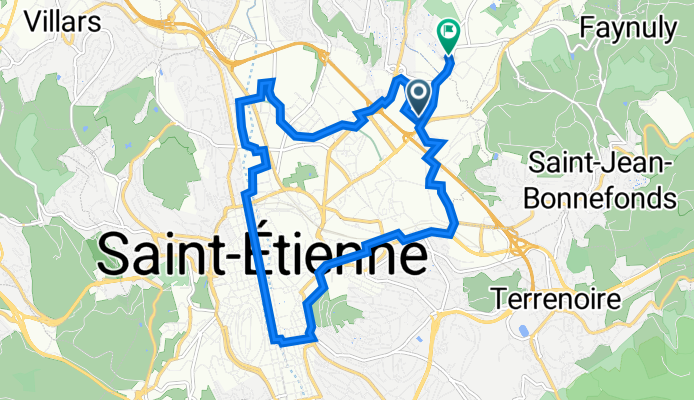
st jean bonnefonds - saint andré le puy
Cycling route in Saint-Jean-Bonnefonds, Auvergne-Rhône-Alpes, France
- 35.5 km
- Distance
- 144 m
- Ascent
- 328 m
- Descent
De Rue de la Talaudière 63, Saint-Étienne à Rue Raoul Follereau 6, La Talaudière
Cycling route in Saint-Jean-Bonnefonds, Auvergne-Rhône-Alpes, France
- 14.7 km
- Distance
- 91 m
- Ascent
- 81 m
- Descent

De Rue Victor Hugo 1, Saint-Jean-Bonnefonds à Rue de la Talaudière 52, Saint-Étienne
Cycling route in Saint-Jean-Bonnefonds, Auvergne-Rhône-Alpes, France
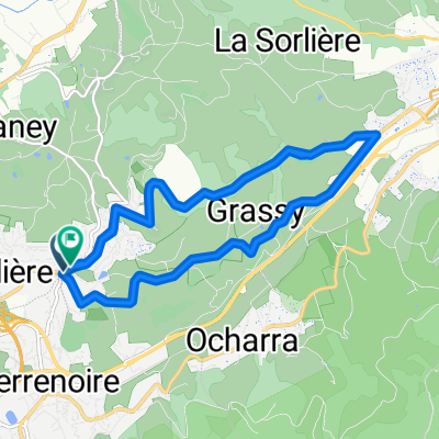
- 3.7 km
- Distance
- 51 m
- Ascent
- 61 m
- Descent

essai
Cycling route in Saint-Jean-Bonnefonds, Auvergne-Rhône-Alpes, France
- 41.8 km
- Distance
- 1,483 m
- Ascent
- 1,467 m
- Descent
Discover more routes
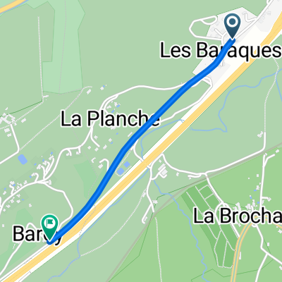
 Route des Barraques, Saint-Jean-Bonnefonds to Rue Jules Ferry, Saint-Étienne
- Distance
- 2.7 km
- Ascent
- 54 m
- Descent
- 12 m
- Location
- Saint-Jean-Bonnefonds, Auvergne-Rhône-Alpes, France
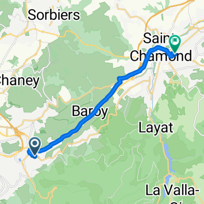
 Route des Barraques, Saint-Chamond to Route des Barraques, Saint-Jean-Bonnefonds
- Distance
- 1.5 km
- Ascent
- 38 m
- Descent
- 17 m
- Location
- Saint-Jean-Bonnefonds, Auvergne-Rhône-Alpes, France
 Sortie 14 juillet
- Distance
- 25.7 km
- Ascent
- 746 m
- Descent
- 746 m
- Location
- Saint-Jean-Bonnefonds, Auvergne-Rhône-Alpes, France
 De 2 Allée du Galibot, Saint-Étienne à 5bis Allée du Galibot, Saint-Étienne
- Distance
- 26.9 km
- Ascent
- 424 m
- Descent
- 425 m
- Location
- Saint-Jean-Bonnefonds, Auvergne-Rhône-Alpes, France
 Itinéraire à partir de ?4ù ?
- Distance
- 9.3 km
- Ascent
- 10 m
- Descent
- 140 m
- Location
- Saint-Jean-Bonnefonds, Auvergne-Rhône-Alpes, France
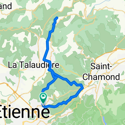
 De Rue Victor Hugo à Route de Terrenoire
- Distance
- 20.8 km
- Ascent
- 425 m
- Descent
- 420 m
- Location
- Saint-Jean-Bonnefonds, Auvergne-Rhône-Alpes, France
 test10
- Distance
- 177.1 km
- Ascent
- 2,665 m
- Descent
- 1,779 m
- Location
- Saint-Jean-Bonnefonds, Auvergne-Rhône-Alpes, France
 De 7 Rue du Puits Lachaud, Saint-Étienne à 5 Allée du Galibot, Saint-Étienne
- Distance
- 9.1 km
- Ascent
- 226 m
- Descent
- 224 m
- Location
- Saint-Jean-Bonnefonds, Auvergne-Rhône-Alpes, France