
Cycling in Rothau
Discover a map of 64 cycling routes and bike trails near Rothau, created by our community.
Region portrait
Get to know Rothau
Find the right bike route for you through Rothau, where we've got 64 cycle routes to explore. Most people get on their bikes to ride here in the months of April and July.
5,191 km
Tracked distance
64
Cycle routes
1,653
Population
Community
Most active users in Rothau


From our community
The best bike routes in and around Rothau

FR3HD-3a-gesamt-So-Vorm-Rennroute
Cycling route in Rothau, Grand Est, France
- 95.6 km
- Distance
- 1,218 m
- Ascent
- 1,502 m
- Descent

Champ de Feux No1
Cycling route in Rothau, Grand Est, France
Vier Anstiege. 3x Strufhof 1x Klingenthal
- 109.6 km
- Distance
- 2,641 m
- Ascent
- 2,650 m
- Descent

3_Le 8 de la Serva
Cycling route in Rothau, Grand Est, France
Double boucle en 8 autour du champ du feu à partir de la Serva.
1ere boucle (10 km) : Serva - Belmont - Col de la Perheux - retour par le versant nord
2e boucle (9 km): Serva - crête des myrtilles - G5 531 - Tour du champ du feu - retour par la croix jaune et les rochers de l'edelweiss et de la princesse Emma.
Belle rando pas trop dure avec nombreuses vues côté ouest sur le Donon et versant est sur le Val de Villé
- 19.1 km
- Distance
- 542 m
- Ascent
- 543 m
- Descent

VTT Chenaudière 4 Plaine Falle Champenay Bénaville 20 km d 574 Difficile.gpx_VTT Cheneaudière 4 - Plaine, La Falle, Champenay, Bénaville
Cycling route in Rothau, Grand Est, France
Métriques calculées à partir des données importéeslundi 22 février 2021 11:54 CETDistance : 21,1 kmDurée : 1 heures, 13 minutes et 56 secondesVitesse moyenne : 17,1 km/hAltitude minimale : 419 mAltitude maximale : 631 mDénivelé positif cumulé : 391 mDénivelé négatif cumulé : 391 m
- 21.2 km
- Distance
- 472 m
- Ascent
- 475 m
- Descent
Discover more routes
 2_Petit tour autour de Stampoumont-Ranrupt
- Distance
- 8 km
- Ascent
- 361 m
- Descent
- 361 m
- Location
- Rothau, Grand Est, France
 Neuviller01
- Distance
- 16.9 km
- Ascent
- 597 m
- Descent
- 597 m
- Location
- Rothau, Grand Est, France
 Alpine Tour 2
- Distance
- 2,124.1 km
- Ascent
- 5,982 m
- Descent
- 5,986 m
- Location
- Rothau, Grand Est, France
 06 Saint Blaise la Roche - Munchhouse
- Distance
- 93.8 km
- Ascent
- 0 m
- Descent
- 0 m
- Location
- Rothau, Grand Est, France
 12137866-Entre Salm et le Ban de la Roche_VTT Cheneaudière 6 - Stampoumont, Bourg-Bruche, Saulxures, St. Blaise-la-Roche
- Distance
- 21 km
- Ascent
- 422 m
- Descent
- 422 m
- Location
- Rothau, Grand Est, France
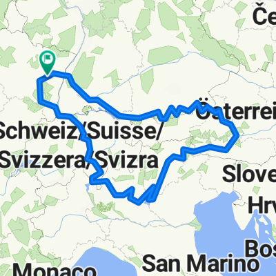
 Rome, Etappe 4, Rothau - Möhlin (ZW)
- Distance
- 179.4 km
- Ascent
- 753 m
- Descent
- 811 m
- Location
- Rothau, Grand Est, France
 Boucle 40 km
- Distance
- 40.2 km
- Ascent
- 997 m
- Descent
- 997 m
- Location
- Rothau, Grand Est, France
 12137866-Entre Salm et le Ban de la Roche_VTT Cheneaudière 2 - Climont, Hang, Source de la Bruche
- Distance
- 25.1 km
- Ascent
- 680 m
- Descent
- 683 m
- Location
- Rothau, Grand Est, France