
Cycling in Riom-ès-Montagnes
Discover a map of 70 cycling routes and bike trails near Riom-ès-Montagnes, created by our community.
Region portrait
Get to know Riom-ès-Montagnes
Find the right bike route for you through Riom-ès-Montagnes, where we've got 70 cycle routes to explore. Most people get on their bikes to ride here in the months of May and July.
5,718 km
Tracked distance
70
Cycle routes
2,902
Population
Community
Most active users in Riom-ès-Montagnes


From our community
The best bike routes in and around Riom-ès-Montagnes


2019-26 Riom-ès-Montagnes to Aurillac
Cycling route in Riom-ès-Montagnes, Auvergne-Rhône-Alpes, France
In 2019, we did self-supported touring for a little less than 2 months from mid-September through early November.
Day 26 - Riom-ès-Montagnes to Aurillac
The ride on D3 was beautiful despite it’s being a relatively major road. Traffic was sparse and we enjoyed the ups
- 84.9 km
- Distance
- 1,008 m
- Ascent
- 1,223 m
- Descent

4.etapa Riom-es-Montagnes - Saint-Cirgues-De-Jordanne
Cycling route in Riom-ès-Montagnes, Auvergne-Rhône-Alpes, France
<span style="font-size: 11pt; line-height: 115%; font-family: "Calibri", "sans-serif";">Kemp v Saint-Cirgues-De-Jordann</span>
Původně jsme měli být v kempu hned po sjezdu z Puy Mary,
ale jediný kemp byl zavřený. Nakonec nám
- 84.3 km
- Distance
- 1,474 m
- Ascent
- 1,454 m
- Descent

Trip vélo Cantal - Corrèze 2011
Cycling route in Riom-ès-Montagnes, Auvergne-Rhône-Alpes, France
- 299.2 km
- Distance
- 2,021 m
- Ascent
- 2,021 m
- Descent

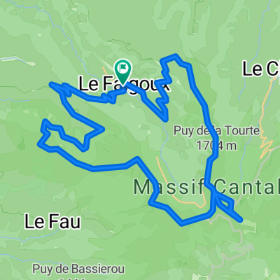
Cantal 2022 N° 2 bis 103km 2110 D+
Cycling route in Riom-ès-Montagnes, Auvergne-Rhône-Alpes, France
le falgoux-puy marie-D 17 dir aurillac-st Simon-rte des crêtes-Cheules-Houde-le Bruel-st georges-le fau-salers-le falgoux
- 103 km
- Distance
- 2,461 m
- Ascent
- 2,469 m
- Descent
Discover more routes
 Cantal 2022 N°1 bis 61km
- Distance
- 60.9 km
- Ascent
- 1,396 m
- Descent
- 1,397 m
- Location
- Riom-ès-Montagnes, Auvergne-Rhône-Alpes, France
 Cantal 2022 circuit N°1 - 43km samedi aprem
- Distance
- 43.2 km
- Ascent
- 951 m
- Descent
- 954 m
- Location
- Riom-ès-Montagnes, Auvergne-Rhône-Alpes, France
 Cantal 2022 N°XL157km 3400D+
- Distance
- 156.9 km
- Ascent
- 3,928 m
- Descent
- 3,928 m
- Location
- Riom-ès-Montagnes, Auvergne-Rhône-Alpes, France
 Cantal 2022 N°2 80km 1580D+
- Distance
- 80.1 km
- Ascent
- 1,648 m
- Descent
- 1,646 m
- Location
- Riom-ès-Montagnes, Auvergne-Rhône-Alpes, France
 Cantal2022 N°3 104km 2400 D+
- Distance
- 103.6 km
- Ascent
- 2,418 m
- Descent
- 2,416 m
- Location
- Riom-ès-Montagnes, Auvergne-Rhône-Alpes, France
 Le Puy Mary (1783m) et la vallée du Falgoux par les crêtes
- Distance
- 43.9 km
- Ascent
- 1,933 m
- Descent
- 1,934 m
- Location
- Riom-ès-Montagnes, Auvergne-Rhône-Alpes, France
 Plateau de Trizac -1568-Utagawa
- Distance
- 40 km
- Ascent
- 946 m
- Descent
- 948 m
- Location
- Riom-ès-Montagnes, Auvergne-Rhône-Alpes, France
 12. Etappe: Condat über Pas de Peyrol
- Distance
- 52.6 km
- Ascent
- 1,064 m
- Descent
- 1,154 m
- Location
- Riom-ès-Montagnes, Auvergne-Rhône-Alpes, France