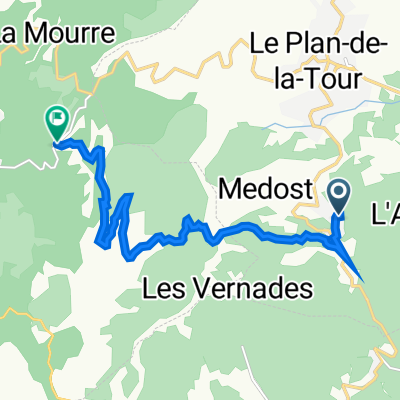
How cycling in Le Plan-de-la-Tour could look like.

Cycling in Le Plan-de-la-Tour

Discover a map of 26 cycling routes and bike trails near Le Plan-de-la-Tour, created by our community.

Region portrait

Get to know Le Plan-de-la-Tour

Find the right bike route for you through Le Plan-de-la-Tour, where we've got 26 cycle routes to explore.

621 km

Tracked distance

26

Cycle routes

2,558

Population

Community

Most active users in Le Plan-de-la-Tour

From our community

The best bike routes in and around Le Plan-de-la-Tour

Le Plan de la Tour - zu Fu脽 und bergauf
MTBUnpaved
Heinz
1

Le Plan de la Tour - zu Fu脽 und bergauf

Cycling route in Le Plan-de-la-Tour, Provence-Alpes-C么te d'Azur Region, France

Diesmal ohne Bike. Offroad. Sehr steinig und felsig. Macht aber viel Spa脽.
3.4 km
Distance
228 m
Ascent
229 m
Descent
Le Plan de la Tour
MTBPavedUnpavedGravel
3

Le Plan de la Tour

Cycling route in Le Plan-de-la-Tour, Provence-Alpes-C么te d'Azur Region, France

Landschaftlich sch枚ne Runde - technisch nicht anspruchsvoll.
27.7 km
Distance
530 m
Ascent
530 m
Descent
Le Plan de la Tour, 27 km
MTBPavedUnpavedGravel
Heinz
0

Le Plan de la Tour, 27 km

Cycling route in Le Plan-de-la-Tour, Provence-Alpes-C么te d'Azur Region, France

Ausgangs- und Endpunkt ist Le Plan de la Tour, ein wundersch枚ner Ort in der Provence,10 km vom Meer entfernt. Die ersten 6 km gehts nur bergauf 眉ber eine erstklassige Strasse. Autoverkehr tendiert gen Null. Ab dort beginnt eine Offroadstrecke f眉r etwa 10 km. Auf halber Strecke vers
25.7 km
Distance
551 m
Ascent
550 m
Descent
Massif des Maures 6
Road bikePaved
2

Massif des Maures 6

Cycling route in Le Plan-de-la-Tour, Provence-Alpes-C么te d'Azur Region, France

37.4 km
Distance
570 m
Ascent
567 m
Descent

Discover more routes