
Cycling in Nogent-sur-Oise
Discover a map of 33 cycling routes and bike trails near Nogent-sur-Oise, created by our community.
Region portrait
Get to know Nogent-sur-Oise
Find the right bike route for you through Nogent-sur-Oise, where we've got 33 cycle routes to explore.
2,522 km
Tracked distance
33
Cycle routes
19,690
Population
Community
Most active users in Nogent-sur-Oise


From our community
The best bike routes in and around Nogent-sur-Oise

Creil - Pierrefonds
Cycling route in Nogent-sur-Oise, Hauts-de-France, France
Par la forêt de Compiègne
- 80.8 km
- Distance
- 337 m
- Ascent
- 264 m
- Descent

Essone - 80km
Cycling route in Nogent-sur-Oise, Hauts-de-France, France
02 novembre 2014
<span style="font-size: 28px; line-height: 1.2em;">79,8km</span>
<div class="label" style="margin: 0px; padding: 0px; cursor: pointer; clear: both; color: rgb(153, 153, 153); -webkit-user-select: none; font-size: 1.2rem; white-space: normal; max-width: 80px; line-height: 1.2em;">
Distance</div>
<span style="font-size: 28px; line-height: 1.2em;">3:50:44</span>
<div class="label" style="margin: 0px; padding: 0px; cursor: pointer; clear: both; color: rgb(153, 153, 153); -webkit-user-select: none; font-size: 1.2rem; white-space: normal; max-width: 80px; line-height: 1.2em;">
Durée de déplacement</div>
<span style="font-size: 28px; line-height: 1.2em;">483m</span>
<div>
<table class="unstyled" style="border-spacing: 0px; padding: 0px; margin: 0px; width: 443px; color: rgb(51, 51, 51); font-family: 'Helvetica Neue', Helvetica, Arial, sans-serif; line-height: 18px;">
<thead>
<tr style="border: none; background: none;">
<th style="padding: 2px 0px; border: none; box-shadow: none; vertical-align: top;">
Moy.</th>
<th style="padding: 2px 60px 2px 0px; border: none; box-shadow: none; vertical-align: top;">
Max.</th>
</tr>
</thead>
<tbody>
<tr style="border: none; background: none;">
<th style="font-weight: 400; padding: 2px 0px; box-shadow: none; border: none; vertical-align: top;">
Vitesse</th>
<td style="padding: 2px 0px; border: none; box-shadow: none; vertical-align: top;">
20,7km/h</td>
<td style="padding: 2px 60px 2px 0px; border: none; box-shadow: none; vertical-align: top;">
56,9km/h</td>
</tr>
</tbody>
<tbody>
<tr style="border: none; background: none;">
<th style="font-weight: 400; padding: 2px 0px; box-shadow: none; border: none; vertical-align: top;">
<span class="glossary-link run-version" data-glossary-term="definition-elapsed-time" style="position: relative; border-bottom-width: 1px; border-bottom-style: dotted; border-bottom-color: rgba(0, 0, 0, 0); display: inline-block; -webkit-transition: border 0.1s linear; transition: border 0.1s linear;">Temps écoulé</span></th>
<td colspan="2" style="padding: 2px 60px 2px 0px; border: none; box-shadow: none; vertical-align: top;">
4:16:42</td>
</tr>
</tbody>
</table>
</div>
- 79.2 km
- Distance
- 259 m
- Ascent
- 237 m
- Descent

AVC Ride #4 :: Creil - Conflans
Cycling route in Nogent-sur-Oise, Hauts-de-France, France
Dimanche 23 Novembre 2014
Départ Paris - Garde du Nord
Train Paris - Creil
Trajet de 62Km avec pause dèj à Pontoise et via l'axe Majeur à Cergy.
Fin du Parcours à Conflans
Retour en RER Conflans - Paris
Arrivée Paris - St. Lazare
- 62.2 km
- Distance
- 130 m
- Ascent
- 134 m
- Descent

Creil-Fécamp
Cycling route in Nogent-sur-Oise, Hauts-de-France, France
- 300 km
- Distance
- 623 m
- Ascent
- 568 m
- Descent
Discover more routes
 a l'aventure
- Distance
- 35.5 km
- Ascent
- 429 m
- Descent
- 423 m
- Location
- Nogent-sur-Oise, Hauts-de-France, France
 Creil-Havre
- Distance
- 285.1 km
- Ascent
- 1,935 m
- Descent
- 1,956 m
- Location
- Nogent-sur-Oise, Hauts-de-France, France
 07 Creil - Senlis - Creil
- Distance
- 14.8 km
- Ascent
- 114 m
- Descent
- 62 m
- Location
- Nogent-sur-Oise, Hauts-de-France, France
 Recovered Route
- Distance
- 11.9 km
- Ascent
- 145 m
- Descent
- 115 m
- Location
- Nogent-sur-Oise, Hauts-de-France, France
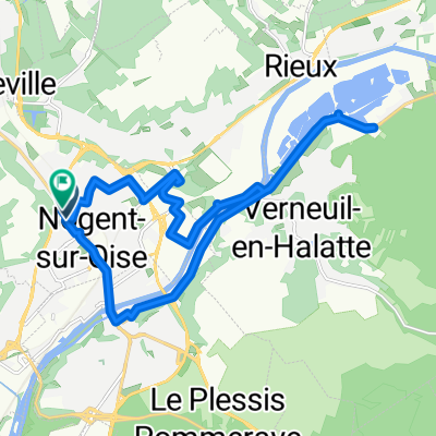 Boulevard Branly, Nogent-sur-Oise à Boulevard Branly, Nogent-sur-Oise
- Distance
- 18.6 km
- Ascent
- 85 m
- Descent
- 84 m
- Location
- Nogent-sur-Oise, Hauts-de-France, France
 32 Place du Général de Gaulle, Creil à 12 Place du Parvis Notre-Dame, Senlis
- Distance
- 12 km
- Ascent
- 104 m
- Descent
- 58 m
- Location
- Nogent-sur-Oise, Hauts-de-France, France
 Tour de France Variant Etape 21 : Creil - Paris Champs Elysées
- Distance
- 115.4 km
- Ascent
- 370 m
- Descent
- 344 m
- Location
- Nogent-sur-Oise, Hauts-de-France, France
 Creil - St Max
- Distance
- 3.9 km
- Ascent
- 42 m
- Descent
- 19 m
- Location
- Nogent-sur-Oise, Hauts-de-France, France