
Cycling in Murat
Discover a map of 142 cycling routes and bike trails near Murat, created by our community.
Region portrait
Get to know Murat
Find the right bike route for you through Murat, where we've got 142 cycle routes to explore. Most people get on their bikes to ride here in the months of May and August.
12,913 km
Tracked distance
142
Cycle routes
2,316
Population
Community
Most active users in Murat


From our community
The best bike routes in and around Murat

C: Lavigerie (pas de peyrol) - Saint-Vincent-de-Cosse, 3. Etappe: Genf - Bordeaux
Cycling route in Murat, Auvergne-Rhône-Alpes, France
- 189.6 km
- Distance
- 892 m
- Ascent
- 1,947 m
- Descent

Massif Central 2009 - Tour 1 - Pässe des Cantal
Cycling route in Murat, Auvergne-Rhône-Alpes, France
- 128.1 km
- Distance
- 2,865 m
- Ascent
- 2,758 m
- Descent

Ride Day 33—14 Oct 2005—15300 Murat to 19110 Bort-les-Orgues
Cycling route in Murat, Auvergne-Rhône-Alpes, France
- 64.9 km
- Distance
- 588 m
- Ascent
- 1,058 m
- Descent
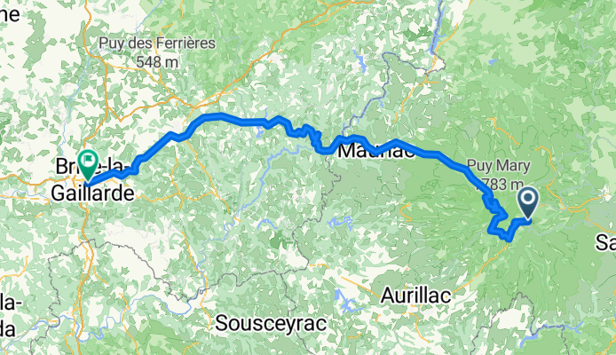
Brive-la-Gaillarde - Super Lioran
Cycling route in Murat, Auvergne-Rhône-Alpes, France
- 164.7 km
- Distance
- 1,566 m
- Ascent
- 2,880 m
- Descent
Discover more routes
 Ride Day 35—16 Oct 2005—15400 Le Claux to 19220 St-Julien-aux-Bois
- Distance
- 65.4 km
- Ascent
- 701 m
- Descent
- 1,161 m
- Location
- Murat, Auvergne-Rhône-Alpes, France
 Le Lioran (15) sur la crête sud de la vallée de la Jordanne
- Distance
- 48.8 km
- Ascent
- 1,998 m
- Descent
- 1,997 m
- Location
- Murat, Auvergne-Rhône-Alpes, France
 Volcan Ouest - 2481-Utagawa
- Distance
- 15.8 km
- Ascent
- 632 m
- Descent
- 633 m
- Location
- Murat, Auvergne-Rhône-Alpes, France
 France2023 E14
- Distance
- 71.2 km
- Ascent
- 1,421 m
- Descent
- 1,644 m
- Location
- Murat, Auvergne-Rhône-Alpes, France
 BTT 2020 - Secteur 2
- Distance
- 211.9 km
- Ascent
- 3,652 m
- Descent
- 4,577 m
- Location
- Murat, Auvergne-Rhône-Alpes, France
 Murat 1 (zuiden)
- Distance
- 108.1 km
- Ascent
- 1,497 m
- Descent
- 1,497 m
- Location
- Murat, Auvergne-Rhône-Alpes, France
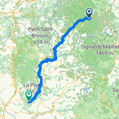
 Murat to Pleaux
- Distance
- 81.8 km
- Ascent
- 1,230 m
- Descent
- 1,487 m
- Location
- Murat, Auvergne-Rhône-Alpes, France
 Cantal 1 - Murat
- Distance
- 96.5 km
- Ascent
- 1,678 m
- Descent
- 1,678 m
- Location
- Murat, Auvergne-Rhône-Alpes, France