
Cycling in Le Malzieu-Ville
Discover a map of 51 cycling routes and bike trails near Le Malzieu-Ville, created by our community.
Region portrait
Get to know Le Malzieu-Ville
Find the right bike route for you through Le Malzieu-Ville, where we've got 51 cycle routes to explore. Most people get on their bikes to ride here in the months of July and August.
3,004 km
Tracked distance
51
Cycle routes
1,023
Population
Community
Most active users in Le Malzieu-Ville

From our community
The best bike routes in and around Le Malzieu-Ville


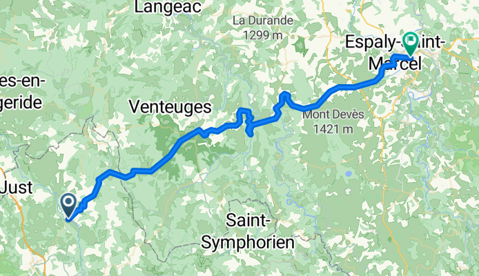
2016 Ride Day 138 - Le Malzieu-Ville to Le-Puy-en-Velay
Cycling route in Le Malzieu-Ville, Occitanie, France
- 70.5 km
- Distance
- 1,221 m
- Ascent
- 1,457 m
- Descent

8.etapa Le Malzieu-Ville - Le Puy-en-Velay
Cycling route in Le Malzieu-Ville, Occitanie, France
- 72.4 km
- Distance
- 1,233 m
- Ascent
- 1,432 m
- Descent

Ardèche-Cévennes-Auvergne_8
Cycling route in Le Malzieu-Ville, Occitanie, France
- 62 km
- Distance
- 993 m
- Ascent
- 1,047 m
- Descent

2004 ツール観戦記 第11ステージ 走行ルート
Cycling route in Le Malzieu-Ville, Occitanie, France
- 513.1 km
- Distance
- 1,595 m
- Ascent
- 2,221 m
- Descent
Discover more routes
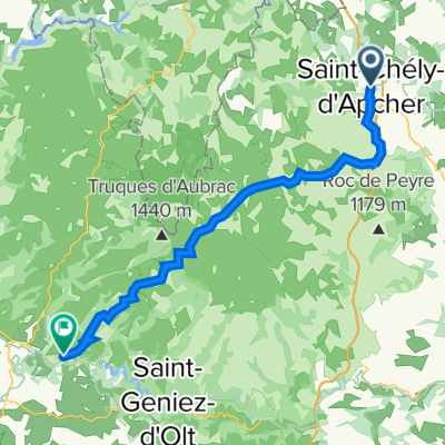
 TMC2_St-Chély-d'Apcher - St-Flour
- Distance
- 65.1 km
- Ascent
- 2,134 m
- Descent
- 2,251 m
- Location
- Le Malzieu-Ville, Occitanie, France
 GTMC 170901
- Distance
- 42.3 km
- Ascent
- 888 m
- Descent
- 589 m
- Location
- Le Malzieu-Ville, Occitanie, France
 Liaison GTMC SCA-Ste Eulalie-SCA
- Distance
- 57.4 km
- Ascent
- 1,192 m
- Descent
- 1,194 m
- Location
- Le Malzieu-Ville, Occitanie, France
 AUV D4 116 km
- Distance
- 111.6 km
- Ascent
- 0 m
- Descent
- 0 m
- Location
- Le Malzieu-Ville, Occitanie, France
 Pont de Gabarit château d orfeuillette
- Distance
- 57 km
- Ascent
- 777 m
- Descent
- 737 m
- Location
- Le Malzieu-Ville, Occitanie, France
 tape 5 : St Chély d'Apcher-St Germain de Calberte
- Distance
- 188.8 km
- Ascent
- 2,321 m
- Descent
- 2,816 m
- Location
- Le Malzieu-Ville, Occitanie, France
 ard etape5
- Distance
- 67.3 km
- Ascent
- 1,142 m
- Descent
- 1,763 m
- Location
- Le Malzieu-Ville, Occitanie, France
 9 Le Malzieu-Ville - Barjac
- Distance
- 51.4 km
- Ascent
- 730 m
- Descent
- 925 m
- Location
- Le Malzieu-Ville, Occitanie, France