
Cycling in Largentière
Discover a map of 112 cycling routes and bike trails near Largentière, created by our community.
Region portrait
Get to know Largentière
Find the right bike route for you through Largentière, where we've got 112 cycle routes to explore. Most people get on their bikes to ride here in the months of June and August.
7,227 km
Tracked distance
112
Cycle routes
2,126
Population
Community
Most active users in Largentière


From our community
The best bike routes in and around Largentière


2016 Ride Day 109 - Largentière to Villefort
Cycling route in Largentière, Auvergne-Rhône-Alpes, France
The first part along D104 and D104A to Les Vans was OK, but there was some traffic and off and on shoulder. D901, after leaving Les Vans, had very little traffic. It was an excellent road...except for the flies.
- 47 km
- Distance
- 863 m
- Ascent
- 386 m
- Descent

La Landeà vélo
Cycling route in Largentière, Auvergne-Rhône-Alpes, France
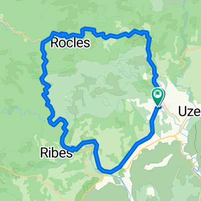
Boucle cyclo de 35 kmà la découverte des jolis villages de caractères de Vinezac, Ailhon et Chassiers. La Lande à vélo, c'est prendre le temps de s'émerveiller devant la singularité et la diversité des paysages ardéchois. Vous cheminerez sur de petites routes, tranquillement à votre rythme entre garrigue et pinède. Prenez le temps de regarder le paysage, de respirer l'air pur, faire une halte dans chacun des 3 villages de caractère et de goûter les produits locaux. Les pierres racontent de belles histoires et les villages de caractère sont comme un poème suspendu dans le temps. Rien de mieux que le vélo pour aller à la rencontre de l'Ardèche et des ardéchois. Alors en selle ! Ce circuit de 35 km est accessible à tous en vélo à assistance électrique ; échappez-vous sur les jolies routes à la découverte des villages de caractère : ▶ Vinezac, village aux accents du sud entouréde vignes. Vous adorerez remonter le temps dans les ruelles étroites du village. ▶ Ailhon, village de caractère du piémont cévenol. Baladez-vous dans les calades et explorez les hameaux nichés dans la forêt pour ressentir l'âme de ce joli village. ▶ Chassiers, village riche en histoire.À la croisée de trois rivières, Chassiers se niche au cœur d'un paysage typiquement cévenol fait de murets de pierres sèches délimitant les cultures en terrasse. Ces 3 villages de caractère sont labellisés Site touristique Accueil Vélo et garantissent des services de qualité pour vous,et votre vélo ! Puis, tout au long du circuit, les adresses Accueil Vélo ont l'art de vous requinquer à coup de sourire et de produits vrais ; et tout ce qu'il faut pour bichonner votre matériel...
- 35.6 km
- Distance
- 502 m
- Ascent
- 502 m
- Descent

Col de Meyrand
Cycling route in Largentière, Auvergne-Rhône-Alpes, France
Vanaf Pied de Bœuf (splitsing D24 en D203)
- 22.2 km
- Distance
- 1,180 m
- Ascent
- 180 m
- Descent

Halbe Tour am Col de Meyrand
Cycling route in Largentière, Auvergne-Rhône-Alpes, France
Rauf bis zum Pass un dgleich wieder runter
- 28.1 km
- Distance
- 921 m
- Ascent
- 916 m
- Descent
Discover more routes
 Rondje vanuit L'Argentiere
- Distance
- 81.3 km
- Ascent
- 1,902 m
- Descent
- 1,923 m
- Location
- Largentière, Auvergne-Rhône-Alpes, France
 Salindré - Rosière
- Distance
- 40 km
- Ascent
- 403 m
- Descent
- 406 m
- Location
- Largentière, Auvergne-Rhône-Alpes, France
 Vogüe 80Km 600m
- Distance
- 80.9 km
- Ascent
- 414 m
- Descent
- 414 m
- Location
- Largentière, Auvergne-Rhône-Alpes, France
 Largentière-Pässefahrt
- Distance
- 84.8 km
- Ascent
- 3,418 m
- Descent
- 3,112 m
- Location
- Largentière, Auvergne-Rhône-Alpes, France
 Laurac Aven Orgnac
- Distance
- 115.6 km
- Ascent
- 933 m
- Descent
- 932 m
- Location
- Largentière, Auvergne-Rhône-Alpes, France
 03.05. Rochecolombe
- Distance
- 34.6 km
- Ascent
- 502 m
- Descent
- 628 m
- Location
- Largentière, Auvergne-Rhône-Alpes, France
 ruoms
ruoms- Distance
- 44.8 km
- Ascent
- 713 m
- Descent
- 710 m
- Location
- Largentière, Auvergne-Rhône-Alpes, France
 Hinweg Ruoms
- Distance
- 17.5 km
- Ascent
- 248 m
- Descent
- 462 m
- Location
- Largentière, Auvergne-Rhône-Alpes, France