
Cycling in Laguiole
Discover a map of 93 cycling routes and bike trails near Laguiole, created by our community.
Region portrait
Get to know Laguiole
Find the right bike route for you through Laguiole, where we've got 93 cycle routes to explore. Most people get on their bikes to ride here in the months of July and August.
6,622 km
Tracked distance
93
Cycle routes
1,317
Population
Community
Most active users in Laguiole

From our community
The best bike routes in and around Laguiole


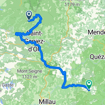
7.etapa St Chely d Aubrac - Le Malzieu-Ville
Cycling route in Laguiole, Occitanie, France
- 80.6 km
- Distance
- 934 m
- Ascent
- 877 m
- Descent
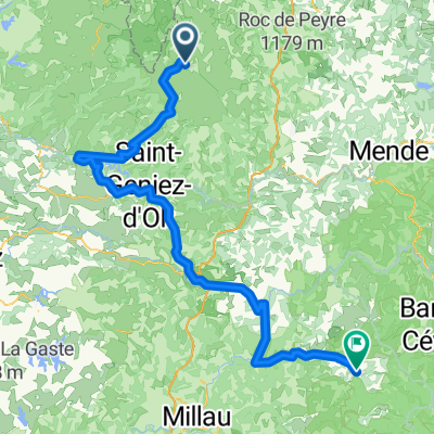
2014 Ride Day 99 - St-Chély-d'Aubrac to Marvejols
Cycling route in Laguiole, Occitanie, France
- 44.7 km
- Distance
- 673 m
- Ascent
- 856 m
- Descent

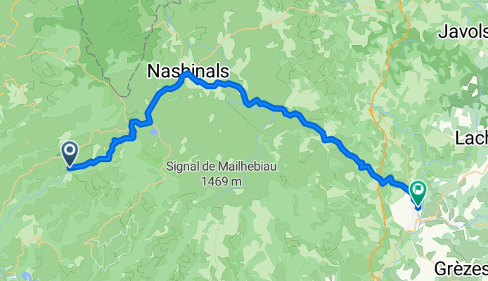
Ride Day 32—13 Oct 2005—48260 Recoules D'Aubrac (Nasbinals) to 15300 Murat
Cycling route in Laguiole, Occitanie, France
- 67.6 km
- Distance
- 587 m
- Ascent
- 757 m
- Descent
Discover more routes
 Nasbidaniel2
- Distance
- 60.7 km
- Ascent
- 627 m
- Descent
- 627 m
- Location
- Laguiole, Occitanie, France
 09-MassifCentral
- Distance
- 60.8 km
- Ascent
- 509 m
- Descent
- 1,057 m
- Location
- Laguiole, Occitanie, France
 TAP J 1
- Distance
- 78.4 km
- Ascent
- 900 m
- Descent
- 1,474 m
- Location
- Laguiole, Occitanie, France
 étape 5
- Distance
- 105 km
- Ascent
- 1,228 m
- Descent
- 1,265 m
- Location
- Laguiole, Occitanie, France
 JATIENZA2
- Distance
- 44.1 km
- Ascent
- 860 m
- Descent
- 858 m
- Location
- Laguiole, Occitanie, France
 Route de Sainte-Urcize 21, Nasbinals nach Avenue Albert Thomas 23, Capdenac-Gare
- Distance
- 114 km
- Ascent
- 2,345 m
- Descent
- 3,338 m
- Location
- Laguiole, Occitanie, France
 Aveyron-Tag1--4-0719 Runde angepasst 2
- Distance
- 138.5 km
- Ascent
- 1,438 m
- Descent
- 1,922 m
- Location
- Laguiole, Occitanie, France
 Aveyron-Tag1--4-0719 Runde angepasst
- Distance
- 142.3 km
- Ascent
- 1,759 m
- Descent
- 1,875 m
- Location
- Laguiole, Occitanie, France