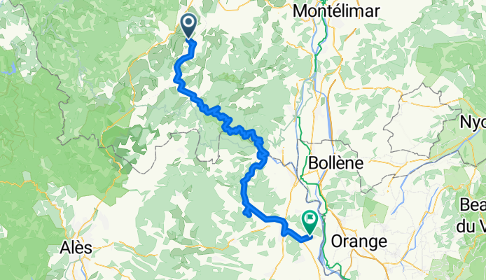
Cycling in Lachapelle-sous-Aubenas
Discover a map of 36 cycling routes and bike trails near Lachapelle-sous-Aubenas, created by our community.
Region portrait
Get to know Lachapelle-sous-Aubenas
Find the right bike route for you through Lachapelle-sous-Aubenas, where we've got 36 cycle routes to explore. Most people get on their bikes to ride here in the months of June and July.
2,828 km
Tracked distance
36
Cycle routes
1,350
Population
Community
Most active users in Lachapelle-sous-Aubenas
From our community
The best bike routes in and around Lachapelle-sous-Aubenas
Vinezac_004
Cycling route in Lachapelle-sous-Aubenas, Auvergne-Rhône-Alpes, France
- 12.1 km
- Distance
- 158 m
- Ascent
- 162 m
- Descent
france 2009-10 balazuc-chusclan
Cycling route in Lachapelle-sous-Aubenas, Auvergne-Rhône-Alpes, France
- 98 km
- Distance
- 573 m
- Ascent
- 717 m
- Descent
VinezacAilhonLentilleresChazeauxChassier
Cycling route in Lachapelle-sous-Aubenas, Auvergne-Rhône-Alpes, France
- 36.2 km
- Distance
- 468 m
- Ascent
- 469 m
- Descent
Vinezac_005
Cycling route in Lachapelle-sous-Aubenas, Auvergne-Rhône-Alpes, France
- 13.2 km
- Distance
- 225 m
- Ascent
- 228 m
- Descent
Discover more routes
 Ardeche 3. Tag
- Distance
- 34 km
- Ascent
- 621 m
- Descent
- 621 m
- Location
- Lachapelle-sous-Aubenas, Auvergne-Rhône-Alpes, France
 Vakantieroute 3 70km
- Distance
- 69.5 km
- Ascent
- 535 m
- Descent
- 535 m
- Location
- Lachapelle-sous-Aubenas, Auvergne-Rhône-Alpes, France
 test
test- Distance
- 15.2 km
- Ascent
- 230 m
- Descent
- 172 m
- Location
- Lachapelle-sous-Aubenas, Auvergne-Rhône-Alpes, France
 france 2009-10 balazuc-balazuc
- Distance
- 81.9 km
- Ascent
- 599 m
- Descent
- 610 m
- Location
- Lachapelle-sous-Aubenas, Auvergne-Rhône-Alpes, France
 RH Vinezac1
- Distance
- 11.8 km
- Ascent
- 163 m
- Descent
- 169 m
- Location
- Lachapelle-sous-Aubenas, Auvergne-Rhône-Alpes, France
 Rit 1 vakantie 2021
- Distance
- 47.2 km
- Ascent
- 666 m
- Descent
- 666 m
- Location
- Lachapelle-sous-Aubenas, Auvergne-Rhône-Alpes, France
 rondje ter verkenning
- Distance
- 48.7 km
- Ascent
- 491 m
- Descent
- 491 m
- Location
- Lachapelle-sous-Aubenas, Auvergne-Rhône-Alpes, France
 24. Balazuc - Vallon Pont d'Arc
- Distance
- 1,208.8 km
- Ascent
- 1,140 m
- Descent
- 1,156 m
- Location
- Lachapelle-sous-Aubenas, Auvergne-Rhône-Alpes, France


