Cycling in Fontanil-Cornillon
Discover a map of 49 cycling routes and bike trails near Fontanil-Cornillon, created by our community.
Region portrait
Get to know Fontanil-Cornillon
Find the right bike route for you through Fontanil-Cornillon, where we've got 49 cycle routes to explore.
2,895 km
Tracked distance
49
Cycle routes
2,642
Population
Community
Most active users in Fontanil-Cornillon
From our community
The best bike routes in and around Fontanil-Cornillon
Alpentocht 2015 Dag 3 Kort 2 Grenoble - Chamberry
Cycling route in Fontanil-Cornillon, Auvergne-Rhône-Alpes, France
Alpentocht 2015 Dag 3 Kort 2 Grenoble - Chamberry
- 98.9 km
- Distance
- 2,003 m
- Ascent
- 1,974 m
- Descent
Alpentocht 2015 Dag 3 Grenoble - Chamberry
Cycling route in Fontanil-Cornillon, Auvergne-Rhône-Alpes, France
Alpentocht 2015 Dag 3 Grenoble - Chamberry
- 114.7 km
- Distance
- 2,556 m
- Ascent
- 2,525 m
- Descent
cardio haha
Cycling route in Fontanil-Cornillon, Auvergne-Rhône-Alpes, France
- 30.9 km
- Distance
- 1,098 m
- Ascent
- 1,097 m
- Descent
St Egreve to St Martin sur la chambre
Cycling route in Fontanil-Cornillon, Auvergne-Rhône-Alpes, France
Chemin du Bois Joli, 73130 Saint-Martin-sur-la-Chambre, France
campingleboisjoli.com
- 104.4 km
- Distance
- 1,849 m
- Ascent
- 1,519 m
- Descent
Discover more routes
 Fontanil_vers_Voiron_col_parménie_retour
- Distance
- 79.5 km
- Ascent
- 829 m
- Descent
- 832 m
- Location
- Fontanil-Cornillon, Auvergne-Rhône-Alpes, France
 Essai Giant
- Distance
- 56.3 km
- Ascent
- 354 m
- Descent
- 357 m
- Location
- Fontanil-Cornillon, Auvergne-Rhône-Alpes, France
 Radtour 2014-01 St. Egrève-St. Georges-des-Hurtières
- Distance
- 107.9 km
- Ascent
- 2,722 m
- Descent
- 2,556 m
- Location
- Fontanil-Cornillon, Auvergne-Rhône-Alpes, France
 Col de Palaquit
- Distance
- 61.1 km
- Ascent
- 1,414 m
- Descent
- 1,410 m
- Location
- Fontanil-Cornillon, Auvergne-Rhône-Alpes, France
 Mont-Saint-Martin depuis Le Fontanil Cornillon
- Distance
- 5.6 km
- Ascent
- 566 m
- Descent
- 25 m
- Location
- Fontanil-Cornillon, Auvergne-Rhône-Alpes, France
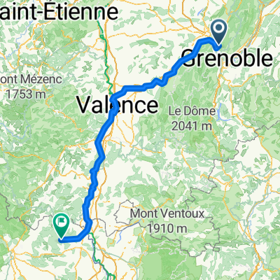
 Chemin de la Digue, Sassenage to Place Championnet 5, Valence
- Distance
- 91.2 km
- Ascent
- 525 m
- Descent
- 600 m
- Location
- Fontanil-Cornillon, Auvergne-Rhône-Alpes, France
 De Rue du Rocher, Fontanil-Cornillon à 2 Rue Carnot, Moirans
- Distance
- 16.7 km
- Ascent
- 69 m
- Descent
- 73 m
- Location
- Fontanil-Cornillon, Auvergne-Rhône-Alpes, France
 Chemin de Namière, Mont-Saint-Martin à Impasse Saint-Hubert, Goudargues
- Distance
- 235.2 km
- Ascent
- 1,479 m
- Descent
- 2,177 m
- Location
- Fontanil-Cornillon, Auvergne-Rhône-Alpes, France


