Cycling in Flamanville
Discover a map of 23 cycling routes and bike trails near Flamanville, created by our community.
Region portrait
Get to know Flamanville
Find the right bike route for you through Flamanville, where we've got 23 cycle routes to explore. Most people get on their bikes to ride here in the month of July.
1,101 km
Tracked distance
23
Cycle routes
1,722
Population
Community
Most active users in Flamanville
From our community
The best bike routes in and around Flamanville
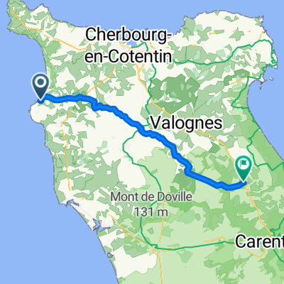
Normandie 2. Tag Flamanville - St. Germain-des-vaux
Cycling route in Flamanville, Normandy, France
- 42.1 km
- Distance
- 407 m
- Ascent
- 459 m
- Descent
Port Dielette 7, Tréauville nach Avenue Carnot 65, Cherbourg-en-Cotentin
Cycling route in Flamanville, Normandy, France
- 32.1 km
- Distance
- 348 m
- Ascent
- 345 m
- Descent
Discover more routes
 vaast loop
- Distance
- 113.2 km
- Ascent
- ---
- Descent
- ---
- Location
- Flamanville, Normandy, France
 les pieux
- Distance
- 8.2 km
- Ascent
- 126 m
- Descent
- 19 m
- Location
- Flamanville, Normandy, France
 Dielette to St Mere-Eglise
- Distance
- 52.5 km
- Ascent
- 295 m
- Descent
- 280 m
- Location
- Flamanville, Normandy, France
 Lääne-Prans3
- Distance
- 459.6 km
- Ascent
- 779 m
- Descent
- 741 m
- Location
- Flamanville, Normandy, France
 Recording from 8 Jul 2017, 10:23 am
- Distance
- 1.8 km
- Ascent
- 7 m
- Descent
- 82 m
- Location
- Flamanville, Normandy, France
 De 4 Route de Havre Jouan, Flamanville à 5–13 Rue du Grand Port, Flamanville
- Distance
- 5 km
- Ascent
- 32 m
- Descent
- 107 m
- Location
- Flamanville, Normandy, France
 Diéllette nach cherbourg
- Distance
- 31.5 km
- Ascent
- 346 m
- Descent
- 347 m
- Location
- Flamanville, Normandy, France
 F08a inkorting via duin- en bospaden
- Distance
- 5.9 km
- Ascent
- 127 m
- Descent
- 43 m
- Location
- Flamanville, Normandy, France


