
Cycling in Égletons
Discover a map of 58 cycling routes and bike trails near Égletons, created by our community.
Region portrait
Get to know Égletons
Find the right bike route for you through Égletons, where we've got 58 cycle routes to explore. Most people get on their bikes to ride here in the month of September.
7,026 km
Tracked distance
58
Cycle routes
5,316
Population
Community
Most active users in Égletons


From our community
The best bike routes in and around Égletons

Égletons bis Clermont-Ferrand optimiert
Cycling route in Égletons, Aquitaine-Limousin-Poitou-Charentes, France
- 125.5 km
- Distance
- 2,153 m
- Ascent
- 2,363 m
- Descent

Von Égletons bis Nébouzat
Cycling route in Égletons, Aquitaine-Limousin-Poitou-Charentes, France
- 105.1 km
- Distance
- 2,130 m
- Ascent
- 1,871 m
- Descent

Von Égletons bis Nébouzat
Cycling route in Égletons, Aquitaine-Limousin-Poitou-Charentes, France
- 104.9 km
- Distance
- 2,127 m
- Ascent
- 1,871 m
- Descent


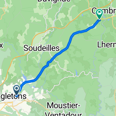
Égletons to Bort-les-Orgues
Cycling route in Égletons, Aquitaine-Limousin-Poitou-Charentes, France
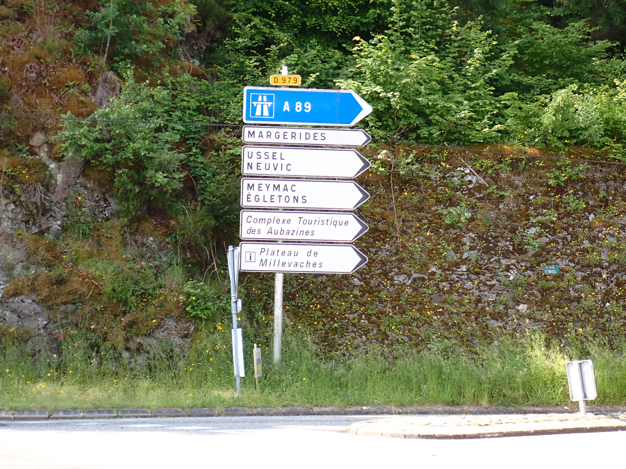
Because of weather forecasts for thunder, lightning, and heavy rain, we took D1089 and D979, which are main roads, instead of the smaller roads that would have been preferable. Neither road had much shoulder, but with the relatively light traffic, it wasn't a problem.
- 51.4 km
- Distance
- 769 m
- Ascent
- 968 m
- Descent
Discover more routes
 Égletons - Circle by Darnets
- Distance
- 24.2 km
- Ascent
- 449 m
- Descent
- 451 m
- Location
- Égletons, Aquitaine-Limousin-Poitou-Charentes, France
 Égletons - Circle through Lafage-sur-Sombre
- Distance
- 30.6 km
- Ascent
- 430 m
- Descent
- 435 m
- Location
- Égletons, Aquitaine-Limousin-Poitou-Charentes, France
 Égletons - Circle to Lamazière-Basse
- Distance
- 35.3 km
- Ascent
- 654 m
- Descent
- 655 m
- Location
- Égletons, Aquitaine-Limousin-Poitou-Charentes, France
 Égletons - Circle to the North through Péret-Bel-Air, Commerly, and St.-Yrieix-le-Déjalat
- Distance
- 49.9 km
- Ascent
- 909 m
- Descent
- 916 m
- Location
- Égletons, Aquitaine-Limousin-Poitou-Charentes, France
 MARCILLAC LA CROISILLE - LAC DE VIAM
- Distance
- 54.4 km
- Ascent
- 608 m
- Descent
- 491 m
- Location
- Égletons, Aquitaine-Limousin-Poitou-Charentes, France
 Vichy - Perpignan 1996 Etappe 6
- Distance
- 55.5 km
- Ascent
- 542 m
- Descent
- 876 m
- Location
- Égletons, Aquitaine-Limousin-Poitou-Charentes, France
 thiers
- Distance
- 10.7 km
- Ascent
- 244 m
- Descent
- 262 m
- Location
- Égletons, Aquitaine-Limousin-Poitou-Charentes, France
 1 Le Raingallier, Darnets à Darnets
- Distance
- 12.5 km
- Ascent
- 253 m
- Descent
- 281 m
- Location
- Égletons, Aquitaine-Limousin-Poitou-Charentes, France