
Cycling in Coise
Discover a map of 66 cycling routes and bike trails near Coise, created by our community.
Region portrait
Get to know Coise
Find the right bike route for you through Coise, where we've got 66 cycle routes to explore. Most people get on their bikes to ride here in the months of June and July.
5,504 km
Tracked distance
66
Cycle routes
1,018
Population


From our community
The best bike routes in and around Coise
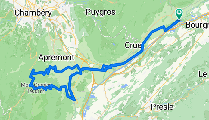
Col du Granier - from lac de Carouge
Cycling route in Coise, Auvergne-Rhône-Alpes, France
- 68.4 km
- Distance
- 1,272 m
- Ascent
- 1,272 m
- Descent
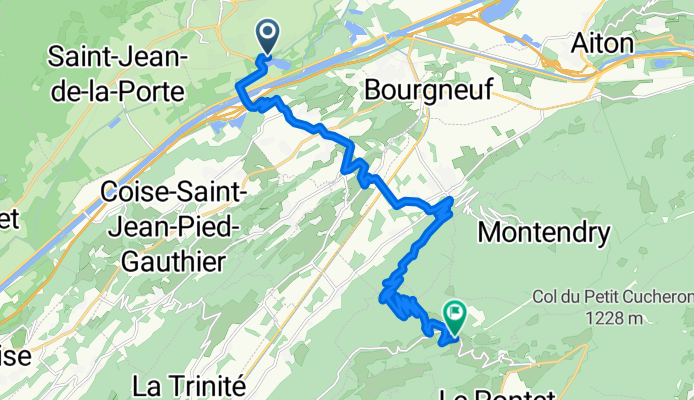
From Saint-Pierre-d'Albigny to Champ-Laurent
Cycling route in Coise, Auvergne-Rhône-Alpes, France
- 18.7 km
- Distance
- 1,073 m
- Ascent
- 252 m
- Descent
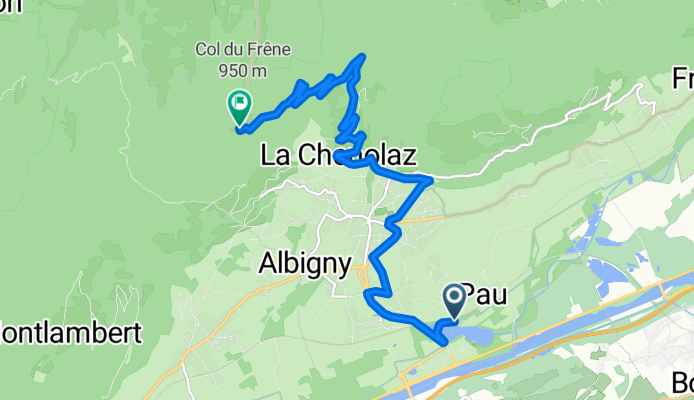
Col du Frêne - from camping Lac de Carouge
Cycling route in Coise, Auvergne-Rhône-Alpes, France
- 10.8 km
- Distance
- 796 m
- Ascent
- 132 m
- Descent

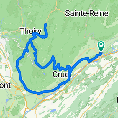
baugesmr
Cycling route in Coise, Auvergne-Rhône-Alpes, France
- 61.7 km
- Distance
- 1,298 m
- Ascent
- 1,326 m
- Descent
Discover more routes
 Lac Carouge - Hurtières - Bauges
- Distance
- 124.6 km
- Ascent
- 2,409 m
- Descent
- 2,407 m
- Location
- Coise, Auvergne-Rhône-Alpes, France
 Marocaz-Prés-Margériaz
- Distance
- 80.8 km
- Ascent
- 1,958 m
- Descent
- 1,958 m
- Location
- Coise, Auvergne-Rhône-Alpes, France
 Col du frene
- Distance
- 7.9 km
- Ascent
- 591 m
- Descent
- 29 m
- Location
- Coise, Auvergne-Rhône-Alpes, France
 Col du Croix de Fer loop
- Distance
- 119.2 km
- Ascent
- 2,001 m
- Descent
- 1,928 m
- Location
- Coise, Auvergne-Rhône-Alpes, France
 3.Etappe (Betton-Grenoble)
- Distance
- 64.4 km
- Ascent
- 369 m
- Descent
- 444 m
- Location
- Coise, Auvergne-Rhône-Alpes, France
 Europa Tour cz.2 26 Saint Pierre d'Albigny - Cerrelaz
- Distance
- 147 km
- Ascent
- ---
- Descent
- ---
- Location
- Coise, Auvergne-Rhône-Alpes, France
 route 6a dag 6 st pierre d albigny - bourg (solo track)
- Distance
- 101.8 km
- Ascent
- 740 m
- Descent
- 306 m
- Location
- Coise, Auvergne-Rhône-Alpes, France
 Col de Prés and Col de Marocaz - From Lac de Carouge
- Distance
- 63.2 km
- Ascent
- 1,541 m
- Descent
- 1,541 m
- Location
- Coise, Auvergne-Rhône-Alpes, France