
Cycling in Ceyzériat
Discover a map of 17 cycling routes and bike trails near Ceyzériat, created by our community.
Region portrait
Get to know Ceyzériat
Find the right bike route for you through Ceyzériat, where we've got 17 cycle routes to explore.
614 km
Tracked distance
17
Cycle routes
2,639
Population
Community
Most active users in Ceyzériat


From our community
The best bike routes in and around Ceyzériat

ain circuit revonnas trefort Pressiat chevannes villereversure
Cycling route in Ceyzériat, Auvergne-Rhône-Alpes, France
- 55.1 km
- Distance
- 384 m
- Ascent
- 384 m
- Descent

Parcours dans le Bugey
Cycling route in Ceyzériat, Auvergne-Rhône-Alpes, France
- 87.6 km
- Distance
- 1,206 m
- Ascent
- 1,207 m
- Descent

SIGNAL du CUIRON, por Ceyzériat
Cycling route in Ceyzériat, Auvergne-Rhône-Alpes, France
- 3.5 km
- Distance
- 252 m
- Ascent
- 7 m
- Descent
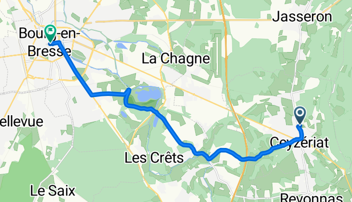
De Allée le Cart 5, Ceyzériat à Rue Notre Dame 1, Bourg-en-Bresse
Cycling route in Ceyzériat, Auvergne-Rhône-Alpes, France
- 10.9 km
- Distance
- 108 m
- Ascent
- 194 m
- Descent
Discover more routes
 Bourg-en-Bresse / Culoz
- Distance
- 149.4 km
- Ascent
- 3,094 m
- Descent
- 3,107 m
- Location
- Ceyzériat, Auvergne-Rhône-Alpes, France
 SIGNAL du CUIRON, por Ceyzériat
- Distance
- 3.5 km
- Ascent
- 260 m
- Descent
- 11 m
- Location
- Ceyzériat, Auvergne-Rhône-Alpes, France
 Rondje Nantua
- Distance
- 98.8 km
- Ascent
- 1,514 m
- Descent
- 1,514 m
- Location
- Ceyzériat, Auvergne-Rhône-Alpes, France
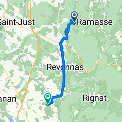
 27 Rue Jérôme Lalande, Ceyzériat a Allée Bresse Revermont, Jasseron
- Distance
- 5.3 km
- Ascent
- 380 m
- Descent
- 426 m
- Location
- Ceyzériat, Auvergne-Rhône-Alpes, France
 De Sous Marchand à Sous Marchand
- Distance
- 47.3 km
- Ascent
- 274 m
- Descent
- 274 m
- Location
- Ceyzériat, Auvergne-Rhône-Alpes, France
 De La Montagne à Chemin des Teppes
- Distance
- 9.5 km
- Ascent
- 45 m
- Descent
- 432 m
- Location
- Ceyzériat, Auvergne-Rhône-Alpes, France
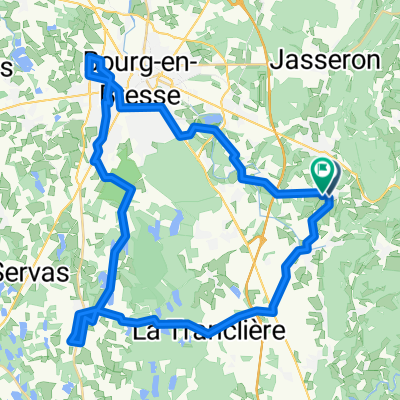
 De Allée le Cart 5, Ceyzériat à Le Cart 1, Ceyzériat
- Distance
- 3.4 km
- Ascent
- 3 m
- Descent
- 37 m
- Location
- Ceyzériat, Auvergne-Rhône-Alpes, France
 Itinéraire à partir de 182 Chemin de Schall, Ceyzériat
- Distance
- 70.1 km
- Ascent
- 551 m
- Descent
- 547 m
- Location
- Ceyzériat, Auvergne-Rhône-Alpes, France