
Cycling in Beaumont-Hague
Discover a map of 54 cycling routes and bike trails near Beaumont-Hague, created by our community.
Region portrait
Get to know Beaumont-Hague
Find the right bike route for you through Beaumont-Hague, where we've got 54 cycle routes to explore. Most people get on their bikes to ride here in the months of July and August.
6,548 km
Tracked distance
54
Cycle routes
1,413
Population
Community
Most active users in Beaumont-Hague


From our community
The best bike routes in and around Beaumont-Hague


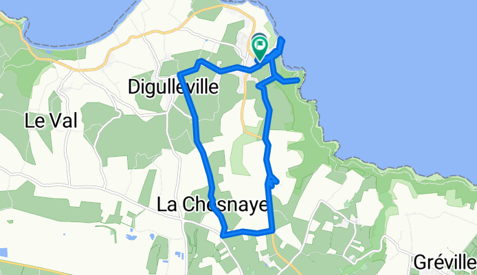
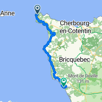
Rue de la Jonquiere nach Rue de la Jonquiere
Cycling route in Beaumont-Hague, Normandy, France
- 12.2 km
- Distance
- 191 m
- Ascent
- 248 m
- Descent


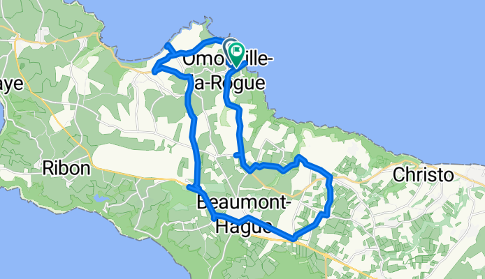
Rue de la Jonquiere nach Rue de la Jonquiere
Cycling route in Beaumont-Hague, Normandy, France
- 24 km
- Distance
- 314 m
- Ascent
- 376 m
- Descent

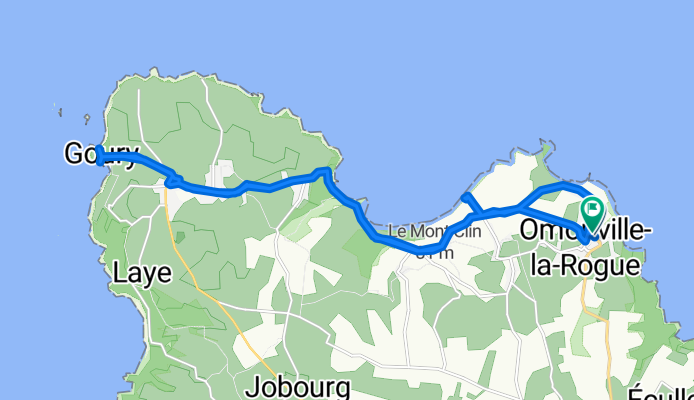
Rue de la Jonquiere nach Rue de la Jonquiere
Cycling route in Beaumont-Hague, Normandy, France
- 20.8 km
- Distance
- 235 m
- Ascent
- 282 m
- Descent
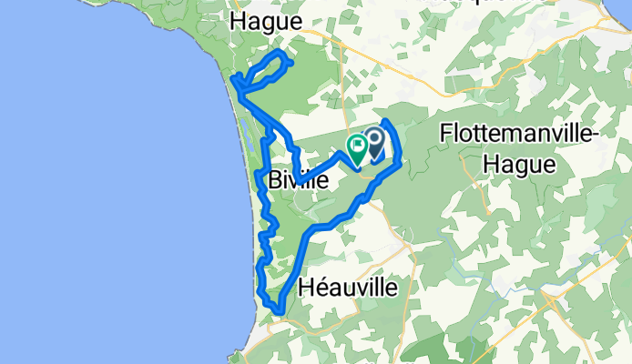
Chemin de la Fontaine, La Hague à Rue des Neuf Vergées, La Hague
Cycling route in Beaumont-Hague, Normandy, France
- 33.8 km
- Distance
- 632 m
- Ascent
- 652 m
- Descent
Discover more routes
![Gruchy 3 [harry made for you]](https://media.bikemap.net/routes/3655225/staticmaps/in_4ff71b2f-7fcc-4550-b538-382eb90936f5_400x400_bikemap-2021-3D-static.png) Gruchy 3 [harry made for you]
Gruchy 3 [harry made for you]- Distance
- 36.2 km
- Ascent
- 431 m
- Descent
- 431 m
- Location
- Beaumont-Hague, Normandy, France
 T stage 20..... Auderville – Le Mont-Saint-Michel 10 Sept 2012
- Distance
- 168.3 km
- Ascent
- 561 m
- Descent
- 605 m
- Location
- Beaumont-Hague, Normandy, France
 jour 2 mod 2
- Distance
- 52.8 km
- Ascent
- 296 m
- Descent
- 466 m
- Location
- Beaumont-Hague, Normandy, France
 a-TF13 Auderville - Portbail
- Distance
- 79.5 km
- Ascent
- 1,031 m
- Descent
- 1,089 m
- Location
- Beaumont-Hague, Normandy, France
 pour aller au landemer
- Distance
- 11.6 km
- Ascent
- 211 m
- Descent
- 205 m
- Location
- Beaumont-Hague, Normandy, France
 Étape 2
- Distance
- 50.7 km
- Ascent
- 828 m
- Descent
- 931 m
- Location
- Beaumont-Hague, Normandy, France
 Jobourg
- Distance
- 7.6 km
- Ascent
- 254 m
- Descent
- 258 m
- Location
- Beaumont-Hague, Normandy, France
 jour 2 mod
- Distance
- 65.2 km
- Ascent
- 285 m
- Descent
- 340 m
- Location
- Beaumont-Hague, Normandy, France