
Cycling in Táplánszentkereszt
Discover a map of 73 cycling routes and bike trails near Táplánszentkereszt, created by our community.
Region portrait
Get to know Táplánszentkereszt
Find the right bike route for you through Táplánszentkereszt, where we've got 73 cycle routes to explore. Most people get on their bikes to ride here in the month of July.
2,555 km
Tracked distance
73
Cycle routes
2,342
Population
Community
Most active users in Táplánszentkereszt


From our community
The best bike routes in and around Táplánszentkereszt

VELOREGIO_12.
Cycling route in Táplánszentkereszt, Vas County, Hungary
- 28.1 km
- Distance
- 33 m
- Ascent
- 33 m
- Descent
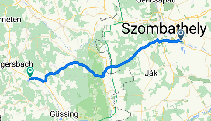
Szombathely-Rauchwart
Cycling route in Táplánszentkereszt, Vas County, Hungary
- 42.3 km
- Distance
- 226 m
- Ascent
- 196 m
- Descent

Szentkirály-Sé-Bucsu-Szentkirály
Cycling route in Táplánszentkereszt, Vas County, Hungary
- 48.6 km
- Distance
- 146 m
- Ascent
- 192 m
- Descent

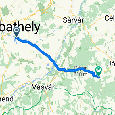
E-bike túra Szombathelyről...
Cycling route in Táplánszentkereszt, Vas County, Hungary
- 36.4 km
- Distance
- 30 m
- Ascent
- 30 m
- Descent
Discover more routes
 Rákóczi Ferenc utca 20, Vasszécseny to Rákóczi Ferenc utca 20, Vasszécseny
- Distance
- 8.4 km
- Ascent
- 61 m
- Descent
- 69 m
- Location
- Táplánszentkereszt, Vas County, Hungary
 Szentkirály-Bozsok
- Distance
- 37.3 km
- Ascent
- 350 m
- Descent
- 348 m
- Location
- Táplánszentkereszt, Vas County, Hungary
 Hat tó túra
- Distance
- 158.9 km
- Ascent
- 424 m
- Descent
- 424 m
- Location
- Táplánszentkereszt, Vas County, Hungary
 Táncsics Mihály utca 1, Táplánszentkereszt to Szabadság utca 56, Bögöte
- Distance
- 35.5 km
- Ascent
- 140 m
- Descent
- 177 m
- Location
- Táplánszentkereszt, Vas County, Hungary
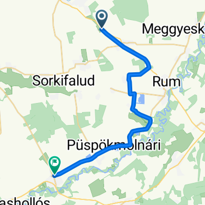
 Péteri köz, Táplánszentkereszt - Rákóczi Ferenc utca 7, Rum
- Distance
- 16.1 km
- Ascent
- 6 m
- Descent
- 31 m
- Location
- Táplánszentkereszt, Vas County, Hungary
 Rákóczi Ferenc utca 20, Vasszécseny to Rákóczi Ferenc utca 20, Vasszécseny
- Distance
- 21 km
- Ascent
- 83 m
- Descent
- 88 m
- Location
- Táplánszentkereszt, Vas County, Hungary
 PANTÉR - VHR
- Distance
- 18.4 km
- Ascent
- 13 m
- Descent
- 16 m
- Location
- Táplánszentkereszt, Vas County, Hungary
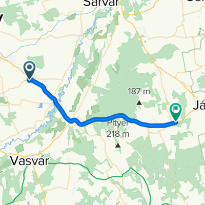 Árpád tér, Csempeszkopács to E66, Vashosszúfalu
- Distance
- 24.7 km
- Ascent
- 100 m
- Descent
- 110 m
- Location
- Táplánszentkereszt, Vas County, Hungary