
Cycling in Pincehely
Discover a map of 35 cycling routes and bike trails near Pincehely, created by our community.
Region portrait
Get to know Pincehely
Find the right bike route for you through Pincehely, where we've got 35 cycle routes to explore.
1,829 km
Tracked distance
35
Cycle routes
2,548
Population
Community
Most active users in Pincehely


From our community
The best bike routes in and around Pincehely

2015 11 05 Tolnanémedi 26km
Cycling route in Pincehely, Tolna County, Hungary
- 26.8 km
- Distance
- 316 m
- Ascent
- 316 m
- Descent

Tamási Mezőny Ob U13, WU13, WU15
Cycling route in Pincehely, Tolna County, Hungary
- 15.2 km
- Distance
- 128 m
- Ascent
- 35 m
- Descent

3napos tervezet 2021
Cycling route in Pincehely, Tolna County, Hungary
- 185.4 km
- Distance
- 274 m
- Ascent
- 268 m
- Descent

Kisszékely strand - Sárbogárd vasútállomás
Cycling route in Pincehely, Tolna County, Hungary
- 38.9 km
- Distance
- 105 m
- Ascent
- 129 m
- Descent
Discover more routes
 Pincehely-Nagyszékely-Kisszekely-Ozora
- Distance
- 66.7 km
- Ascent
- 478 m
- Descent
- 482 m
- Location
- Pincehely, Tolna County, Hungary
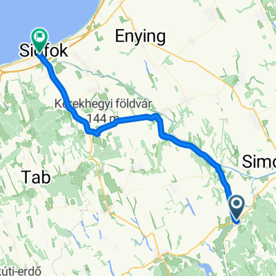
 Pincehely Siofok
- Distance
- 46.1 km
- Ascent
- 157 m
- Descent
- 156 m
- Location
- Pincehely, Tolna County, Hungary
 Pincehely Balaton monti
- Distance
- 44.4 km
- Ascent
- 149 m
- Descent
- 144 m
- Location
- Pincehely, Tolna County, Hungary
 Pincehely - Miszla - Kisszekely - Pálfa
- Distance
- 58.2 km
- Ascent
- 425 m
- Descent
- 426 m
- Location
- Pincehely, Tolna County, Hungary
 Pincehely-Ozora-Tamasi-Pincehely
- Distance
- 48.4 km
- Ascent
- 277 m
- Descent
- 280 m
- Location
- Pincehely, Tolna County, Hungary
 2014 10 09 SImontornya 24,8km
- Distance
- 25.5 km
- Ascent
- 199 m
- Descent
- 229 m
- Location
- Pincehely, Tolna County, Hungary
 Pincehely Tab 100km
- Distance
- 100.3 km
- Ascent
- 425 m
- Descent
- 427 m
- Location
- Pincehely, Tolna County, Hungary
 Gárdonyi Géza utca 4., Pincehely to Fő utca 138., Siófok
- Distance
- 48.2 km
- Ascent
- 430 m
- Descent
- 429 m
- Location
- Pincehely, Tolna County, Hungary