
Cycling in Bátonyterenye
Discover a map of 242 cycling routes and bike trails near Bátonyterenye, created by our community.
Region portrait
Get to know Bátonyterenye
Find the right bike route for you through Bátonyterenye, where we've got 242 cycle routes to explore. Most people get on their bikes to ride here in the months of July and August.
14,752 km
Tracked distance
242
Cycle routes
14,214
Population
Community
Most active users in Bátonyterenye


Handpicked routes
Discover Bátonyterenye through these collections
Tour
From our community
The best bike routes in and around Bátonyterenye

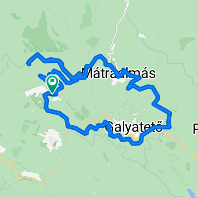
Panoráma Körút a Felső Mátrában
Cycling route in Bátonyterenye, Nógrád megye, Hungary
- 19.4 km
- Distance
- 308 m
- Ascent
- 306 m
- Descent

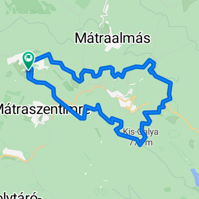
Kazár-Riolittufa
Cycling route in Bátonyterenye, Nógrád megye, Hungary
- 22.2 km
- Distance
- 194 m
- Ascent
- 194 m
- Descent

Kis edzés a Mátra északi lábánál I.
Cycling route in Bátonyterenye, Nógrád megye, Hungary
- 54 km
- Distance
- 532 m
- Ascent
- 532 m
- Descent

Sámsonháza
Cycling route in Bátonyterenye, Nógrád megye, Hungary
- 37.9 km
- Distance
- 207 m
- Ascent
- 207 m
- Descent
Discover more routes
 princz
- Distance
- 37.7 km
- Ascent
- 610 m
- Descent
- 608 m
- Location
- Bátonyterenye, Nógrád megye, Hungary
 Kisterenye-Szilvásvárad-Eger (Mátra@Bükk)
- Distance
- 92.1 km
- Ascent
- 468 m
- Descent
- 505 m
- Location
- Bátonyterenye, Nógrád megye, Hungary
 Mátra kiskör
- Distance
- 27.9 km
- Ascent
- 473 m
- Descent
- 467 m
- Location
- Bátonyterenye, Nógrád megye, Hungary
 Mátraszentistván/ Sípark- Fekete tó (ZÖLD)
- Distance
- 8.1 km
- Ascent
- 146 m
- Descent
- 221 m
- Location
- Bátonyterenye, Nógrád megye, Hungary
 Kellemes 20 km
- Distance
- 20.2 km
- Ascent
- 310 m
- Descent
- 310 m
- Location
- Bátonyterenye, Nógrád megye, Hungary
 Mátra Második nap
- Distance
- 19 km
- Ascent
- 365 m
- Descent
- 362 m
- Location
- Bátonyterenye, Nógrád megye, Hungary
 Karancs
- Distance
- 52.4 km
- Ascent
- 413 m
- Descent
- 417 m
- Location
- Bátonyterenye, Nógrád megye, Hungary
 OKKT 2 - Heves-Borsodi-dombság
- Distance
- 81.5 km
- Ascent
- 505 m
- Descent
- 505 m
- Location
- Bátonyterenye, Nógrád megye, Hungary