Cycling in Strigno
Discover a map of 27 cycling routes and bike trails near Strigno, created by our community.
Region portrait
Get to know Strigno
Find the right bike route for you through Strigno, where we've got 27 cycle routes to explore.
4,187 km
Tracked distance
27
Cycle routes
1,377
Population
Community
Most active users in Strigno
From our community
The best bike routes in and around Strigno
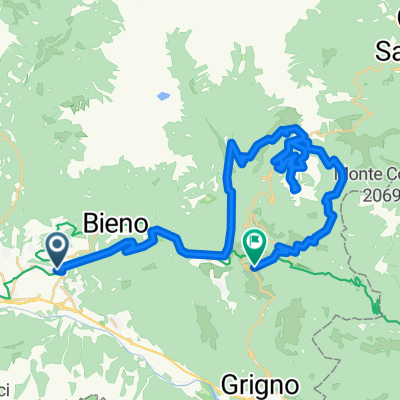
Strigno - Passo 5 Croci
Cycling route in Strigno, Trentino-Alto Adige, Italy
- 21.9 km
- Distance
- 1,642 m
- Ascent
- 50 m
- Descent
U96 2014 Etappe 5b Strigno (Val Sugana) - Crespano d' Grappa (Alternative)
Cycling route in Strigno, Trentino-Alto Adige, Italy
U96 2014 Etappe 5b Strigno (Val Sugana) - Crespano d' Grappa (Alternative)
- 129.6 km
- Distance
- 2,771 m
- Ascent
- 3,098 m
- Descent
U96 2014 Etappe 5 Strigno (Val Sugana) - Crespano d' Grappa (Option)
Cycling route in Strigno, Trentino-Alto Adige, Italy
U96 2014 Etappe 5 Strigno (Val Sugana) - Crespano d' Grappa
- 132.4 km
- Distance
- 2,756 m
- Ascent
- 3,083 m
- Descent
ferie luglio
Cycling route in Strigno, Trentino-Alto Adige, Italy
- 1,067 km
- Distance
- 530 m
- Ascent
- 887 m
- Descent
Discover more routes
 Strigno - LaBassa
- Distance
- 38.8 km
- Ascent
- 1,505 m
- Descent
- 216 m
- Location
- Strigno, Trentino-Alto Adige, Italy
 Strigno - M.te Lisser
- Distance
- 35 km
- Ascent
- 1,487 m
- Descent
- 294 m
- Location
- Strigno, Trentino-Alto Adige, Italy
 U96 2014 Etappe 5 Strigno (Val Sugana) - Crespano d' Grappa
- Distance
- 149.7 km
- Ascent
- 3,324 m
- Descent
- 3,649 m
- Location
- Strigno, Trentino-Alto Adige, Italy
 Supertest Manghen/Rolle/Brocon
- Distance
- 156.5 km
- Ascent
- 4,255 m
- Descent
- 4,255 m
- Location
- Strigno, Trentino-Alto Adige, Italy
 Strigno - Monte Agaro
- Distance
- 45.2 km
- Ascent
- 1,680 m
- Descent
- 1,251 m
- Location
- Strigno, Trentino-Alto Adige, Italy
 AX16 Etappe6
- Distance
- 66.7 km
- Ascent
- 1,853 m
- Descent
- 2,106 m
- Location
- Strigno, Trentino-Alto Adige, Italy
 Via Guglielmo Marconi 13, Castel Ivano to Via della Posta 4–16, Bolzano
- Distance
- 82.7 km
- Ascent
- 3,620 m
- Descent
- 3,829 m
- Location
- Strigno, Trentino-Alto Adige, Italy
 Strigno to Strada senza nome, Scurelle
- Distance
- 21 km
- Ascent
- 1,772 m
- Descent
- 482 m
- Location
- Strigno, Trentino-Alto Adige, Italy


