
Cycling in Panicale
Discover a map of 30 cycling routes and bike trails near Panicale, created by our community.
Region portrait
Get to know Panicale
Find the right bike route for you through Panicale, where we've got 30 cycle routes to explore.
3,414 km
Tracked distance
30
Cycle routes
510
Population
Community
Most active users in Panicale


From our community
The best bike routes in and around Panicale
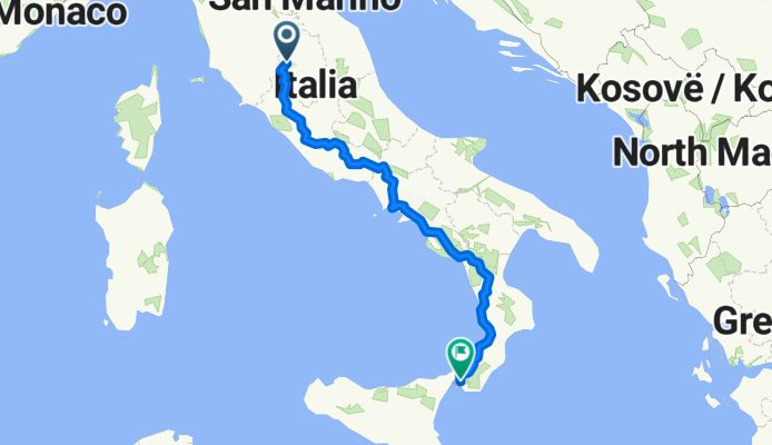
Via Pietro Vannucci, Panicale nach Via Aschenez, Reggio di Calabria
Cycling route in Panicale, Umbria, Italy
- 1,191.5 km
- Distance
- 24,473 m
- Ascent
- 24,852 m
- Descent

Rund um den Lago Trasimeno
Cycling route in Panicale, Umbria, Italy
- 63.2 km
- Distance
- 279 m
- Ascent
- 275 m
- Descent

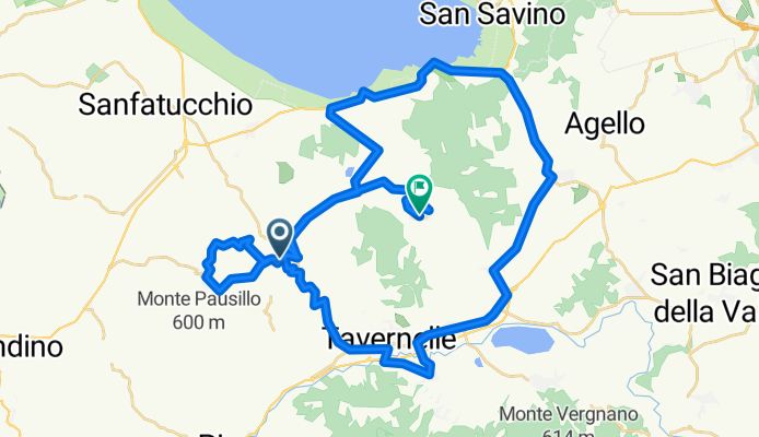
Monte Melino CLONED FROM ROUTE 117543
Cycling route in Panicale, Umbria, Italy
- 42.3 km
- Distance
- 699 m
- Ascent
- 634 m
- Descent
Discover more routes
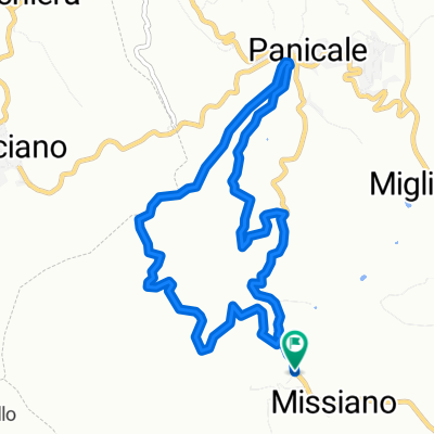 Panicale-Missiano-Monte Petrarvella
- Distance
- 8.5 km
- Ascent
- 361 m
- Descent
- 359 m
- Location
- Panicale, Umbria, Italy
 5. Panicale-Citta della Pieve (crono)
- Distance
- 24.7 km
- Ascent
- 360 m
- Descent
- 282 m
- Location
- Panicale, Umbria, Italy
 Mongiovino
- Distance
- 27.9 km
- Ascent
- 564 m
- Descent
- 562 m
- Location
- Panicale, Umbria, Italy
 panicale to cortona
- Distance
- 36.5 km
- Ascent
- 300 m
- Descent
- 232 m
- Location
- Panicale, Umbria, Italy
 Montali_27_05_2017
- Distance
- 20.8 km
- Ascent
- 431 m
- Descent
- 432 m
- Location
- Panicale, Umbria, Italy
 macchia 4 b
- Distance
- 55.1 km
- Ascent
- 3,255 m
- Descent
- 3,257 m
- Location
- Panicale, Umbria, Italy
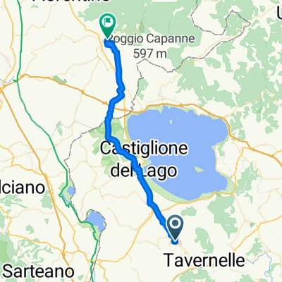
 Via Trasimeno, Panicale do Via del Pozzino 2, Castiglione del Lago
- Distance
- 14.2 km
- Ascent
- 183 m
- Descent
- 181 m
- Location
- Panicale, Umbria, Italy
 Magione a Via Lorenzo Milani, Magione
- Distance
- 83 km
- Ascent
- 1,187 m
- Descent
- 1,176 m
- Location
- Panicale, Umbria, Italy